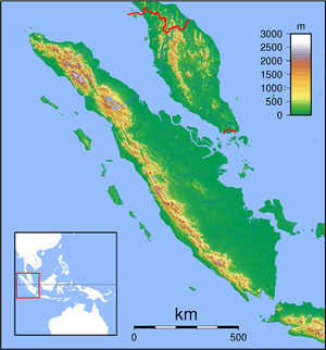
1943 Alahan Panjang earthquakes
 | |
| Date | June 8 and June 9, 1943 [1] |
|---|---|
| Magnitude | Mw 7.2 |
| Depth | 50 km (31 mi) [1] |
| Epicenter | 1°00′S 101°00′E / 1.0°S 101.0°E [1] |
| Areas affected | Indonesia |
The 1943 Alahan Panjang earthquakes occurred on June 8 and June 9 UTC (June 9, 1943, local time) in Sumatra, then under Japanese occupation. This was an earthquake doublet (the shocks occurred at the same location on consecutive days).[2]
The first mainshock occurred on June 8 at 20:42 UTC. It ruptured the Suliti segment of the Sumatran Fault Zone. The magnitude was given as Mw 7.2,[1] or Ms 7.1.[3]
The second mainshock occurred on June 9 at 03:06 UTC. It ruptured the Sumani segment of the Sumatran Fault Zone and perhaps the northwestern part of the Suliti segment. The magnitude was given as Mw 7.5,[1] or Ms 7.4.[3]
Alahan Panjang was damaged in the earthquakes.[2] Right lateral offsets were reported near the town of Solok.[3]
Near the Sumani segment, earthquake doublets occurred repeatedly.[4] Similar earthquake doublet nearby include the earthquakes in 1926 and 2007.[5]
See also
References
- 1 2 3 4 5 Engdahl, E. R.; Vallaseñor, A. (2002). "Global seismicity: 1900–1999". International Handbook of Earthquake & Engineering Seismology (PDF). Part A, Volume 81A (First ed.). Academic Press. p. 678. ISBN 978-0124406520.
- 1 2 http://www.jeofizikci.org/Makale/SumatranFault.pdf
- 1 2 3 Natawidjaja, D. H. (2003), Neotectonics of the Sumatran fault and paleogeodesy of the Sumatran subduction zone, Dissertation (Ph.D.), California Institute of Technology
- ↑ "Source model of an earthquake doublet that occurred in a pull-apart basin along the Sumatran fault, Indonesia" by M. Nakano, H. Kumagai, S. Toda, R. Ando, T. Yamashina, H. Inoue, Sunarjo.
- ↑ http://www.jsce.or.jp/report/45/files/singkarak_earthquake_jsce2007.pdf