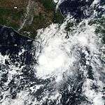
2000 Pacific hurricane season
| |
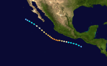
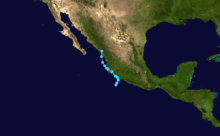
| Season summary map |
| First system formed |
May 22, 2000 |
| Last system dissipated |
November 8, 2000 |
| Strongest storm1 |
Carlotta – 932 mbar (hPa) (27.52 inHg), 155 mph (250 km/h) (1-minute sustained) |
| Total depressions |
21 |
| Total storms |
19 |
| Hurricanes |
6 |
| Major hurricanes (Cat. 3+) |
2 |
| Total fatalities |
18 |
| Total damage |
$14 million (2000 USD) |
| 1Strongest storm is determined by lowest pressure |
Pacific hurricane seasons
1998, 1999, 2000, 2001, 2002 |
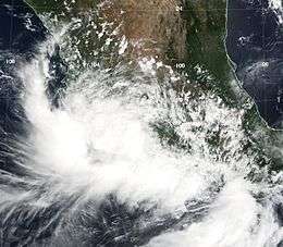
The 2000 Pacific hurricane season was an active Pacific hurricane season. There were few notable storms this year. Tropical Storms Miriam, Norman, and Rosa all made landfall in Mexico with minimal impact. Hurricane Daniel briefly threatened the U.S. state of Hawaii while weakening. Hurricane Carlotta was the strongest storm of the year and the second strongest June hurricane in recorded history. It killed 18 people when it sank a freighter.
Season summary
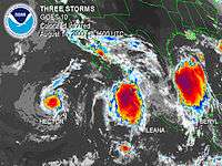
Hurricane Hector and Tropical Storm Ileana on August 14, with
Tropical Storm Beryl in the Gulf of Mexico also visible
The 2000 Pacific hurricane season officially started on May 15, 2000 in the eastern Pacific, and on June 1, 2000 in the central Pacific, and lasted until November 30, 2000. These dates conventionally delimit the period of each year when most tropical cyclones form in the northeastern Pacific Ocean.
This season had an above average number of storms. However, it had a below average number of hurricanes and major hurricanes. There were also two tropical depressions that did not reach storm strength. In the central Pacific, two tropical storms formed. The first storm formed on May 22 and the last storm dissipated on November 8.
Storms
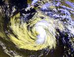
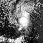
Hurricane Aletta
| Category 2 hurricane (SSHWS) |
|
|
| Duration |
May 22 – May 28 |
| Peak intensity |
105 mph (165 km/h) (1-min) 970 mbar (hPa) |
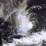
A tropical wave crossed Central America and entered the Gulf of Tehuantepec on May 20. Deep convection developed near a center, and the system became the first tropical depression of the season on May 22 while located south of Acapulco, Mexico.[1] A mid-level ridge forced a west-northwest track away from the Mexican coast.[2] It intensified into Tropical Storm Aletta early on May 23 while located 220 mi (350 km) south of Zihuatanejo, Mexico, becoming the first May tropical storm in four years. As it turned westward, it continued a slow intensification trend, before strengthening more quickly due to decreased wind shear. On May 24 Aletta attained hurricane status, and shortly thereafter reached peak winds of 105 mph (165 km/h); this made it a Category 2 on the Saffir-Simpson scale.[1]
After maintaining peak winds for about 18 hours, Aletta began a weakening trend due to increasing wind shear. At around the same time, a trough eroded the ridge that was steering the movement of Aletta, causing the hurricane to remain almost stationary for the next two days. The lack of motion resulted in upwelling which imparted additional weakening, and Aletta weakened to tropical storm status on May 27. It quickly deteriorated that day, and on May 28 the system dissipated well south of Cabo San Lucas after it began a slow north drift. The remnants lingered in the same area for the next several days.[1] Aletta caused no known damages or casualties.[1] Hurricane Aletta was the second-strongest May hurricane by pressure, as well as the fourth strongest May hurricane by winds.[3]
Tropical Storm Bud
| Tropical storm (SSHWS) |
|
|
| Duration |
June 13 – June 17 |
| Peak intensity |
50 mph (85 km/h) (1-min) 994 mbar (hPa) |
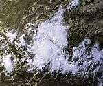
A tropical wave that will eventually become Tropical Storm Bud was first identified off the coast of Africa on May 22. It moved across the Atlantic Ocean and Caribbean Sea, then into the eastern Pacific Ocean on June 6 with little development. The tropical wave remained disorganized until June 11 when a broad low pressure area developed southwest of Acapulco, Mexico. The wave was only intensifying slowly, and on June 13, it became strong enough to be designated as a tropical depression. It quickly strengthened to tropical storm intensity six hours later, and moved to the northwest.[4] It was forecast to strengthen to a strong tropical storm with winds reaching 70 mph (110 km/h),[5] but the storm only reached a peak intensity of 50 mph (85 km/h) early on June 14. Bud turned to the north-northwest, and slowly weakened from June 15 onwards, due to increasing vertical wind shear and cooler ocean water temperatures.[4] The storm's forward speed decreased and began to meander, as the ridge to the north of Bud weakens and a trough develops over the western United States.[6] It drifted erratically while located just north of Socorro Island, and was downgraded to a tropical depression on June 16. By the next day, it dissipated into an area of low pressure, however, it continued to exist until June 19.[4]
Bud passed near Socorro Island on June 15, with estimated one-minute winds of 45 mph (75 km/h), and caused large waves along the western coast of Mexico. However, no reports of damage or casualties were received.[4]
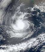
Hurricane Carlotta
| Category 4 hurricane (SSHWS) |
|
|
| Duration |
June 18 – June 25 |
| Peak intensity |
155 mph (250 km/h) (1-min) 932 mbar (hPa) |
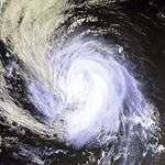
A tropical wave that entered the Pacific Ocean acquired a closed circulation and became a depression on June 18. It strengthened into a storm June 19 and a hurricane the next day. Carlotta then began explosively deepening, and it strengthened into a Category 4 hurricane on June 21. It then began to reduce its forward speed and slowly weaken as its path paralleled the Pacific coast of Mexico. Carlotta weakened to a storm on June 24 and a depression June 25. The cyclone dissipated shortly thereafter.
Though it never made landfall, Carlotta killed 18 people when it sank the Lithuanian freighter M/V Linkuva. Carlotta is also the third most intense June tropical cyclone in the east Pacific; only Ava of 1973 and Celia of 2010 were stronger.
Tropical Depression Four-E
| Tropical depression (SSHWS) |
|
|
| Duration |
July 6 – July 7 |
| Peak intensity |
30 mph (45 km/h) (1-min) 1007 mbar (hPa) |
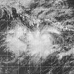
Tropical Depression Four-E was a short-lived storm that formed from the same tropical wave that spawned Tropical Depression Two in the Atlantic Ocean. The tropical wave crossed Central America between June 30 and July 1, continuing to move westward into the Pacific Ocean. The wave became more organized on July 6 and the National Hurricane Center started issuing advisories on the newly developed tropical depression later that day.[7] The hurricane center predicted that the depression will reach tropical storm intensity, as there was a lack of vertical wind shear around the system and sea surface temperatures were warm enough for intensification to occur.[8] The depression lacked any deep convection, however, and it began weakening on the next day.[9] It was dissipating late in the day as the storm moved into an area of stronger wind shear.[10]
Tropical Storm Upana
| Tropical storm (SSHWS) |
|
|
| Duration |
July 20 – July 24
(classified by JMA on July 27) |
| Peak intensity |
45 mph (75 km/h) (1-min) 1006 mbar (hPa) |
A tropical wave organized into Tropical Depression One-C on July 20 while located southeast of the Hawaiian Islands. It strengthened slowly and moved nearly due west, before reaching storm strength later on July 20. The storm was named Upana, which is Hawaiian for "Urban". Despite a favorable environment, Upana strengthened little, reaching a peak intensity on July 21 with winds of 50 mph (85 km/h). The storm had no deep convection in its circulation on July 22, and was downgraded to a tropical depression in the afternoon. Late on July 23, deep convection flared up, briefly strengthening the storm, but failed to become a tropical storm again, as it remained poorly organized. It dissipated on July 24, despite a low shear environment favorable for development.[11]
Upana is the first storm in the Central Pacific Hurricane Center's area of responsibility to be named in July, and the first tropical storm to develop in the region since Tropical Storm Paka in the 1997 season. Upana's remnants continued moving to the west, where JMA classified its remnants a tropical depression, but east of the International Date Line on July 27. It crossed the International Date Line later that day. The remnants encountered a favorable environment just west of the dateline, and developed into Tropical Depression 12W. The depression strengthened into Tropical Storm Chanchu. The name Chanchu, submitted by Macau, is a Cantonese word for pearl. Chanchu moved north, and had dissipated by July 30.[12]
Gary Padgett suggested that there was good evidence Chanchu was actually a regeneration of Upana. The official policy is that dateline crossers keep their name. However, there was supposedly some doubt at the time so Chanchu and Upana were officially treated as distinct tropical cyclones. Also, since Upana had dissipated several days earlier, and the Joint Typhoon Warning Center had already assigned a new number for the system, Gary Padgett deemed it likely that the Japan Meteorological Agency's decision to rename the cyclone was the best choice.[12]
Tropical Depression Five-E
| Tropical depression (SSHWS) |
|
|
| Duration |
July 22 – July 23 |
| Peak intensity |
35 mph (55 km/h) (1-min) 1005 mbar (hPa) |
The origins of Tropical Depression Five-E were first identified on July 8 when a tropical wave moved off the west African coast. It entered the eastern Pacific Ocean on July 16 after tracking over the Caribbean Sea. The wave developed to a tropical depression on July 22.[13] It lacked any deep convection and it was moving over cold waters, so it never intensified further to a tropical storm.[14] The depression dissipated late on July 23, one day after it formed to a depression.[15]
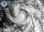
Hurricane Daniel
| Category 3 hurricane (SSHWS) |
|
|
| Duration |
July 23 – August 5 |
| Peak intensity |
125 mph (205 km/h) (1-min) 954 mbar (hPa) |
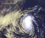
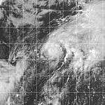
Hurricane Daniel reached Category 3 intensity and briefly threatened Hawaii as a tropical storm, but veered to the northwest as it approached the islands.
No casualties or damaged was reported in association with Hurricane Daniel, despite the system's passing close enough to Hawaii to require tropical storm warnings. It still produced heavy surf conditions along the northern shores of the Hawaiian Islands. Daniel was the first tropical cyclone to be a significant threat to Hawaii since 1994.
Tropical Storm Emilia
| Tropical storm (SSHWS) |
|
|
| Duration |
July 26 – July 30 |
| Peak intensity |
65 mph (100 km/h) (1-min) 994 mbar (hPa) |
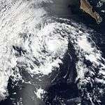
On July 11, a tropical wave moved off the African coast, and moved to the Lesser Antilles one week later. It passed over Central America near Panama on July 22 without any increase in organization. On July 25, the wave began to show curved banding, showing that it had become better organized. It intensified to a tropical depression on July 26 while located south southwest of Manzanillo, Mexico, designated as Tropical Depression Seven-E. The depression was upgraded to Tropical Storm Emilia later that day while moving northwest, steered by a mid-level ridge to its north.[16] During this time, Emilia was forecast to strengthen to a hurricane within two days, due to the system moving over warm waters.[17] However, late on July 27, the storm began to accelerate, meaning that it will move into cooler waters sooner than firstly anticipated, therefore, only allowing the storm to intensify within a few hours before weakening.[18] Emilia moved near Socorro Island and its intensity peaked with wind speeds of 65 mph (100 km/h), with an eyewall beginning to form. A few hours later, the storm moved into cooler waters and drier air, and Emilia's deep convection dissipated, weakening the storm.[16] Late on July 28 deep convection redeveloped near the storm's center, but wind shear prevented Emilia from strengthening.[19] It turned to the west and weakened below tropical storm intensity on July 29,[16] as the deep convection in the storm diminished again.[20] It shortly dissipated while located several hundred miles west south-west of Cabo San Lucas, Mexico.[16]
Tropical Storm Fabio
| Tropical storm (SSHWS) |
|
|
| Duration |
August 3 – August 8 |
| Peak intensity |
50 mph (85 km/h) (1-min) 1000 mbar (hPa) |
A tropical wave moved off the west coast of Africa on July 19, and entered into the Pacific on July 27. Minimal development occurred in the west-northwestward moving wave until August 1. It was then that the tropical wave began developing a low-level circulation and convective organization was seen to the south of Manzanillo, Colima, Mexico. The system continued to become better organized, and was classified as Tropical Depression Eight-E, which was centered about 621 mi (999 km) west-southwest of Manzanillo on August 3 at 1200 UTC. The depression initially moved west-northwestward about 15 mph (24 km/h), and later slowed and turned westward on August 4. As the depression had curved westward, it had intensified enough to be upgraded to Tropical Storm Fabio. Despite the presence of wind shear, Fabio continued to strengthen and reach a peak intensity of 50 mph (85 km/h) later that day. Fabio turned toward west-southwest while weakening on August 5. Fabio weakened back to a tropical depression on August 6 and dissipated two days later about 1,347 mi (2,168 km) west-southwest of Cabo San Lucas, Mexico. The remnant swirl of low clouds persisted for several more days, eventually undergoing a Fujiwhara interaction with the remains of Hurricane Gilma.[21]
Hurricane Gilma
| Category 1 hurricane (SSHWS) |
|
|
| Duration |
August 5 – August 11 |
| Peak intensity |
80 mph (130 km/h) (1-min) 984 mbar (hPa) |
Gilma was a Category 1 hurricane (on the Saffir-Simpson Hurricane Scale) that took a climatological west-northwesterly track over the open waters of the eastern North Pacific.
Hurricane Hector
| Category 1 hurricane (SSHWS) |
|
|
| Duration |
August 10 – August 16 |
| Peak intensity |
80 mph (130 km/h) (1-min) 983 mbar (hPa) |
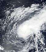
In the middle of August, two tropical storms developed off the Mexican coastline. Hector became a hurricane and moved out to sea, and Ileana became a strong tropical storm that neared, but never made landfall on the Mexican coastline. Hector formed southwest of Mexico, moved westward and dissipated over colder water southwest of Baja California. The remnants of Hector passed over the Hawaiian Islands several days later, producing heavy rain over most of the island chain.
Tropical Storm Ileana
| Tropical storm (SSHWS) |
|
|
| Duration |
August 13 – August 17 |
| Peak intensity |
70 mph (110 km/h) (1-min) 991 mbar (hPa) |
Ileana was a strong tropical storm that briefly threatened the southwest coast of mainland Mexico and the southern tip of the Baja California peninsula before abruptly turning away from Baja California and dissipating over open water.
Tropical Storm Wene
| Tropical storm (SSHWS) |
|
|
| Duration |
August 15 (Entered basin) – August 17 |
| Peak intensity |
50 mph (85 km/h) (1-min) 1002 mbar (hPa) |
A tropical disturbance developed in the Western Pacific Ocean along the eastern periphery of the monsoon trough in mid-August. Located at 33° north, it steadily organized, and became Tropical Depression Sixteen-W on August 15 while located 1,700 miles (2,745.9 km) to the northwest of Honolulu, Hawaii. It moved eastward along the west-east oriented surface pressure trough, and crossed the International Date Line later on August 15. Abnormally warm sea surface temperatures allowed the system to intensify despite its unusually high latitude, and it became Tropical Storm Wene on August 16. It quickly attained a peak intensity of 50 mph (85 km/h), but weakened due to colder sea surface temperatures and wind shear. Wene continued to weaken, and dissipated when the storm merged with an extratropical cyclone.[11]
As a depression, Wene was the first Western Pacific tropical cyclone to cross the dateline since the 1996 season. The name Wene is Hawaiian for "Wayne".[11]
Tropical Storm John
| Tropical storm (SSHWS) |
|
|
| Duration |
August 28 – September 1 |
| Peak intensity |
70 mph (110 km/h) (1-min) 994 mbar (hPa) |
John originated on August 28 from an area of disturbed weather that was associated with the intertropical convergence zone (ITCZ) near just outside the Central Pacific basin. Developing near the Central Pacific basin, John eventually entered early on August 30 and was then also monitored by the Central Pacific Hurricane Center. that was a tropical storm for several days and moved from the eastern to the central Pacific basin. Thereafter entering the central Pacific region, Tropical Storm John approached hurricane status while meandering erratically east-southeast of Hawaii. John eventually encountered strong wind shear, and dissipated on September 1. Tropical Storm John did not cause any damage or fatalities, as there were no reports of any land being affect.[22]
Tropical Storm Kristy
| Tropical storm (SSHWS) |
|
|
| Duration |
August 31 – September 3 |
| Peak intensity |
40 mph (65 km/h) (1-min) 1004 mbar (hPa) |
Part of the same tropical wave that spawned Tropical Storm Chris in the Atlantic uneventfully crossed the rest of the Atlantic and passed far out to sea into the Pacific before it organized into Tropical Depression Fourteen-E on August 31. Despite significant shear, the depression strengthened into Tropical Storm Kristy as it meandered far from land over the open ocean. The shear then destroyed the system on September 3 where it was at a place just 210 kilometers from where it first organized. There were no effects anywhere.
Hurricane Lane
| Category 2 hurricane (SSHWS) |
|
|
| Duration |
September 5 – September 14 |
| Peak intensity |
100 mph (155 km/h) (1-min) 967 mbar (hPa) |
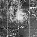
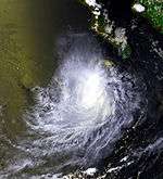
The precursor to Lane was a tropical wave that formed in the Atlantic Ocean on August 20. The wave moved across the Atlantic basin without development and crossed Central America on August 29. By September 1, the system was beginning to organize south of Mexico. On September 4, the system became a tropical depression 140 miles (225 km) southwest of Manzanillo, Mexico. The next day the tropical depression became Tropical Storm Lane. After becoming a tropical storm, Lane executed a counter-clockwise loop, during that maneuver, the storm crossed its own wake and weakened slightly. After the storm finished the loop, it continued to move westward where it reached hurricane strength on September 9 while passing over Socorro Island. By September 11, Lane encountered cooler waters which weakened the hurricane back to tropical storm strength. Lane then encountered a trough that had formed off the western United States coastline. The interaction with the system caused Lane to curve northeast towards the West Coast of the United States. On September 13, Lane passed over cooler waters, causing it to weaken to a tropical depression. Lane then dissipated on the next day.[23]
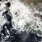
On September 9, forecasters predicted that the storm would remain offshore and its rainbands would bring heavy rains and gusty winds across the Baja California.[24] However, because forecasters predicted that the storm would stay offshore, and so no warnings or watches were issued. Lane passed directly over Socorro Island where a weather station recorded a pressure of 973 mb.[23] Although the center of Lane was well offshore, it still brought heavy surf that closed several ports in Mexico.[25] In an Jose del Cabo, Mexico, a weather station reported winds of 32 mph (52 km/h).[23] Lane remnants then affected the Western United States. The moisture from Lane produced thunderstorms in northern California.[26] At all locations, effects were minimal, with no reports of damage or casualties.[23]
Tropical Storm Miriam
| Tropical storm (SSHWS) |
|
|
| Duration |
September 15 – September 17 |
| Peak intensity |
40 mph (65 km/h) (1-min) 1004 mbar (hPa) |
A tropical wave moved off the coast of Africa on August 29. It remained weak as it moved westward across the Atlantic Ocean, and entered the Pacific Ocean on September 9. As it moved west-northwestward, it organized, and developed into Tropical Depression Fifteen-E on September 15 while 290 miles (466.7 km) east-southeast of Cabo San Lucas, Baja California Sur. Banding features became more pronounced, though convection remained intermittent. On September 16, the depression briefly became Tropical Storm Miriam, though quickly weakened back to a tropical depression as it continued north-northwestward. Miriam dissipated on September 17 while 70 miles (112.6 km) northeast of Cabo San Lucas. Tropical storm force winds were never reported, and it is possible Miriam never attained tropical storm status.[27]
Miriam dropped lighter than average rainfall upon Mexico, peaking at 7.68 in (195 mm) at La Cruz/Elota.[28] Total damages from the storm amounted to $7.2 million (MXN; $558,000 2000 USD, $768 thousand 2016 USD).[29] By October 24, a national disaster declaration was signed for areas affected by Tropical Storm Miriam in Baja California Sur.[30]
Tropical Storm Norman
| Tropical storm (SSHWS) |
|
|
| Duration |
September 20 – September 22 |
| Peak intensity |
50 mph (85 km/h) (1-min) 998 mbar (hPa) |
The same tropical wave that spawned Atlantic Hurricane Gordon organized into an area of low pressure in the Eastern Pacific Ocean on September 18. Its convection slowly organized while south of Mexico, and a tropical depression formed on September 20 while 205 miles (330 km) south-southeast of Manzanillo, Colima. Weak steering currents forced the depression to drift slowly northward, and later on September 20 it strengthened into Tropical Storm Norman. Norman quickly reached peak winds of 50 mph (85 km/h) before making landfall in western Mexico. The storm rapidly weakened to a tropical depression over land, but Norman maintained its circulation and some deep convection as it turned to the northwest. It emerged over water on September 22, but turned to the northeast, made landfall again in Mexico, and dissipated later that day.[31]
Norman produced heavy rainfall across western Mexico, peaking at nearly 16 in (410 mm) in the state of Colima.[32] In all, Norman caused $13.3 million (2000 USD; $18.3 million 2016 USD) in damage.[29]
Tropical Storm Olivia
| Tropical storm (SSHWS) |
|
|
| Duration |
October 2 – October 10 |
| Peak intensity |
65 mph (100 km/h) (1-min) 994 mbar (hPa) |
Olivia was a tropical storm that formed off the southwest coast of mainland Mexico, and generally tracked west-northwestward and remained over open water. After dissipating as a tropical cyclone, the remnant low-level circulation tracked across central Baja California, northwest Mexico and the desert southwest United States.
Tropical Storm Paul
| Tropical storm (SSHWS) |
|
|
| Duration |
October 25 – October 29 |
| Peak intensity |
45 mph (75 km/h) (1-min) 1003 mbar (hPa) |
An area of disturbed weather emerged from the ITCZ on October 22. Located several hundred miles south-southeast of the Gulf of Tehuantepec, convection gradually organized and increased, and by October 25 satellite images indicated the development of the eighteenth tropical depression of the season.[33] Operationally it was not classified until 15 hours later.[34] The depression moved westward throughout its duration,[33] and based on Dvorak estimates, intensified into Tropical Storm Paul on October 26. Despite increasing wind shear ahead of the storm, the National Hurricane Center predicted steady intensification to near hurricane status,[35] although Paul only attained peak winds of 45 mph (75 km/h).[33]
As wind shear increased and convection became disorganized, Paul weakened. A trough briefly curved it to the northwest, before resuming its westward motion.[33] Although the convection was becoming displaced from the low-level circulation, the National Hurricane Center continued to predict strengthening.[36] However, the thunderstorms became minimal,[37] and Paul weakened to a tropical depression early on October 28.[33] The circulation center deteriorated, and although there were bursts in convection,[38] Paul dissipated early on October 29, as it was becoming indistinguishable in the ITCZ.[39] The remnants continued westward, and interacted with an upper-level low, affecting Hawaii with heavy rainfall in early November. The flooding caused $70 million in damage, and the highest rainfall total was 38.76 in (985 mm) at Kapapala Ranch.[40] That rainfall total makes Paul the second rainiest tropical cyclone in Hawaii, behind only Hurricane Hiki of 1950.[41]
Tropical Storm Rosa
| Tropical storm (SSHWS) |
|
|
| Duration |
November 3 – November 8 |
| Peak intensity |
65 mph (100 km/h) (1-min) 993 mbar (hPa) |
The origins of Tropical Storm Rosa can be traced to a tropical wave that moved off the coast of Africa on October 18. It showed signs of development in the southwestern Caribbean Sea, though moved into the East Pacific Ocean on November 1 before being able to develop further. Favorable conditions allowed the system to quickly organize, and the wave formed into Tropical Depression Nineteen-E on November 3 while 230 mi (370 km) south of the El Salvador – Guatemala border. A ridge of high pressure to its north forced the depression westward, where it slowly organized into a tropical storm on November 5. A mid-level trough eroded the high pressure system, allowing Rosa to turn more to the north. On November 6, the storm reached a peak of 65 mph (100 km/h), though Rosa slowly weakened as it accelerated to the northeast. On November 8, the storm made landfall on the southern coast of Mexico with winds of 40 mph (65 km/h), and quickly dissipated.[42]
Rosa dropped moderate rainfall across Mexico, peaking at 15.32 in (389 mm) near the Mexico/Guatemala border.[43] Damage was minimal, totaling to only $15,000 (2000 USD; $20.6 thousand 2016 USD).[29] Rosa was the first November storm since Hurricane Rick in the 1997 season.[3]
Other storms
Tropical Depression Chanchu
| Tropical depression (SSHWS) |
|
|
| Duration |
July 26 – July 27 (Exited basin) |
| Peak intensity |
30 mph (45 km/h) (1-min) 1007 mbar (hPa) |
According to the Joint Typhoon Warning Center, on July 26 a tropical depression formed east of the International Dateline, and soon it exited CPHC's area of responsibility;[44] however, this storm wasn't included into CPHC database. As it entered into western Pacific, it strengthened as a tropical storm and received the name Chanchu. It is possible and strongly suggested that Chanchu was a regeneration of Tropical Storm Upana.
Storm names
The following names were used for named storms that formed in the eastern Pacific in 2000. Names that were not assigned are marked in gray No names were retired, so it was used again in the 2006 Pacific hurricane season. This is the same list used for the 1994 season.
- Aletta
- Bud
- Carlotta
- Daniel
- Emilia
- Fabio
- Gilma
- Hector
|
- Ileana
- John
- Kristy
- Lane
- Miriam
- Norman
- Olivia
- Paul
|
- Rosa
-
Sergio (unused)
-
Tara (unused)
-
Vicente (unused)
-
Willa (unused)
-
Xavier (unused)
-
Yolanda (unused)
-
Zeke (unused)
|
For storms that form in the Central Pacific Hurricane Center's area of responsibility, encompassing the area between 140 degrees west and the International Date Line, all names are used in a series of four rotating lists. The next four names that were slated for use in 2000 are shown below, however only two of them were used.
See also
References
- 1 2 3 4 Pasch, Richard (June 10, 2000). "Hurricane Aletta Tropical Cyclone Report". National Hurricane Center. Archived from the original on May 14, 2011. Retrieved April 21, 2011.
- ↑ Franklin, James (May 22, 2000). "Tropical Depression One-E Discussion #1". National Hurricane Center. Retrieved April 21, 2011.
- 1 2 National Hurricane Center; Hurricane Research Division; Central Pacific Hurricane Center. "The Northeast and North Central Pacific hurricane database 1949–2015". United States National Oceanic and Atmospheric Administration's National Weather Service. A guide on how to read the database is available here.
- 1 2 3 4 Beven, Jack (2000-07-21). "Tropical Storm Bud Tropical Cyclone Report". National Hurricane Center. Archived from the original on May 14, 2011. Retrieved April 21, 2011.
- ↑ Lawrence, Miles (June 13, 2000). "Tropical Storm Bud Discussion #3". National Hurricane Center. Retrieved April 21, 2011.
- ↑ Avila, Lixion (June 15, 2000). "Tropical Storm Bud Discussion #8". National Hurricane Center. Retrieved April 21, 2011.
- ↑ Avila, Lixion (July 12, 2000). "Tropical Depression Four-E Tropical Cyclone Report". National Hurricane Center. Archived from the original on May 14, 2011. Retrieved April 21, 2011.
- ↑ Stewart, Stacy; Pasch, Richard (July 6, 2000). "Tropical Depression Four-E Discussion #1". National Hurricane Center. Retrieved April 21, 2011.
- ↑ Stewart, Stacy (July 7, 2000). "Tropical Depression Four-E Discussion #3". National Hurricane Center. Retrieved April 21, 2011.
- ↑ Pasch, Richard (June 7, 2000). "Tropical Depression Four-E Discussion #4". National Hurricane Center. Retrieved April 21, 2011.
- 1 2 3 Kodama, Keven; Rosendal, Hans; Hablutzel, Benjamin; Jendrowski, Paul; Eum, Daniel (2000). "The 2000 Central Pacific Tropical Cyclone Season". Central Pacific Hurricane Center. Archived from the original on May 18, 2011. Retrieved April 20, 2011.
- 1 2 Gary Padgett; John Wallace (2000). "Monthly Global Tropical Cyclone Summary July 2000". Archived from the original on April 20, 2011. Retrieved May 11, 2007.
- ↑ Stewart, Stacy (August 5, 2000). "Tropical Depression Five-E Tropical Cyclone Report". National Hurricane Center. Archived from the original on May 14, 2011. Retrieved April 21, 2011.
- ↑ Pasch, Richard (July 23, 2000). "Tropical Depression Five-E Discussion #3". National Hurricane Center. Retrieved April 21, 2011.
- ↑ Beven, Jack (July 23, 2000). "Tropical Depression Five-E Discussion #4". National Hurricane Center. Retrieved April 21, 2011.
- 1 2 3 4 Pasch, Richard (December 19, 2000). "Tropical Storm Emilia Tropical Cyclone Report". National Hurricane Center. Archived from the original on May 14, 2011. Retrieved April 20, 2011.
- ↑ Avila, Lixion (July 27, 2000). "Tropical Storm Emilia Discussion #3". National Hurricane Center. Retrieved April 20, 2011.
- ↑ Franklin, James (July 27, 2000). "Tropical Storm Emilia Discussion #6". National Hurricane Center. Retrieved April 20, 2011.
- ↑ Stewart, Stacy; Lawrence, Miles (July 28, 2000). "Tropical Storm Emilia Discussion #9". National Hurricane Center. Retrieved April 20, 2011.
- ↑ Lawrence, Miles (July 9, 2000). "Tropical Depression Emilia Discussion #14". National Hurricane Center. Retrieved April 20, 2011.
- ↑ Beven, Jack (November 17, 2000). "Tropical Storm Fabio Tropical Cyclone Report". National Hurricane Center. Archived from the original on June 29, 2011. Retrieved July 20, 2011.
- ↑ Lawrence, Miles (October 17, 2000). "Tropical Storm John Tropical Cyclone Report". National Hurricane Center. Archived from the original on June 4, 2011. Retrieved June 10, 2011.
- 1 2 3 4 Beven, Jack (November 24, 2000). "Hurricane Lane Tropical Cyclone Report". National Hurricane Center. Retrieved April 20, 2011.
- ↑ Lawrence, Miles (September 9, 2000). "Hurricane Lane Discussion No. 16". National Hurricane Center. Retrieved April 20, 2011.
- ↑ "Hurricane Lane shuts Mexican ports, brings rain". CNN. September 11, 2000. Archived from the original on April 20, 2011. Retrieved April 20, 2011.
- ↑ Cappella, Chris (2000). "Hurricane Lane brushes Mexican peninsula". USA Today. Archived from the original on April 20, 2011. Retrieved April 20, 2011.
- ↑ Franklin, James (November 3, 2000). "Tropical Storm Miriam Tropical Cyclone Report". National Hurricane Center. Archived from the original on May 14, 2011. Retrieved April 20, 2011.
- ↑ Roth, David (January 27, 2007). "Tropical Storm Miriam – September 14–18, 2000". Hydrometeorological Prediction Center. Retrieved April 20, 2011.
- 1 2 3 Bitrán, Daniel; Espinosa, Martín; Morales, Héctor; Salinas, Marco; Conde, María; Ramírez, Lucía; Quintana, Krishna; Colsa, Lorena (November 2001). "Impacto socioeconómico de los principales desastres ocurridos en a la República Mexicana en el año 2000" (PDF) (in Spanish). CENAPRED. Archived from the original (PDF) on October 30, 2008. Retrieved April 20, 2011.
- ↑ Secretary of the Interior (October 24, 2000). "Official Journal for Tuesday October 24, 2000" (PDF) (in Spanish). Government of Mexico. Archived (PDF) from the original on April 20, 2011. Retrieved August 25, 2009.
- ↑ Avila, Lixion; Blake, Eric (October 13, 2000). "Tropical Storm Norman Tropical Cyclone Report". National Hurricane Center. Archived from the original on May 14, 2011. Retrieved April 20, 2011.
- ↑ Roth, David (June 16, 2007). "Tropical Storm Norman – September 16–24, 2000". Hydrometeorological Prediction Center. Archived from the original on May 18, 2011. Retrieved April 20, 2011.
- 1 2 3 4 5 Lawrence, Miles (November 18, 2000). "Tropical Storm Paul Tropical Cyclone Report". National Hurricane Center. Archived from the original on May 14, 2011. Retrieved April 20, 2011.
- ↑ Franklin, James (October 25, 2000). "Tropical Depression Eighteen Discussion #1". National Hurricane Center. Retrieved April 20, 2011.
- ↑ Franklin, James (October 26, 2000). "Tropical Storm Paul Discussion #4". National Hurricane Center. Retrieved April 20, 2011.
- ↑ Stewart, Stacy (October 27, 2000). "Tropical Storm Paul Discussion #9". National Hurricane Center. Retrieved April 20, 2011.
- ↑ Beven, Jack (October 27, 2000). "Tropical Storm Paul Discussion #10". National Hurricane Center. Retrieved April 20, 2011.
- ↑ Stewart, Stacy (October 28, 2000). "Tropical Depression Paul Discussion #12". National Hurricane Center. Retrieved April 20, 2011.
- ↑ Beven, Jack (October 29, 2000). "Tropical Depression Paul Discussion No. 14". National Hurricane Center. Retrieved April 20, 2011.
- ↑ Roth, David (June 27, 2007). "Remains of Paul – November 1–3, 2000". Hydrometeorological Prediction Center. Archived from the original on May 19, 2011. Retrieved April 20, 2011.
- ↑ Roth, David M. (April 29, 2015). "Tropical Cyclone Point Maxima". Tropical Cyclone Rainfall Data. United States Weather Prediction Center. Retrieved May 8, 2016.
- ↑ Pasch, Richard (December 21, 2000). "Tropical Storm Rosa Tropical Cyclone Report". National Hurricane Center. Archived from the original on May 14, 2011. Retrieved April 20, 2011.
- ↑ Roth, David (January 27, 2007). "Tropical Storm Rosa – November 3–8, 2000". Hydrometeorological Prediction Center. Archived from the original on May 18, 2011. Retrieved April 20, 2011.
- ↑ "bwp061998" (TXT). Joint Typhoon Warning Center. 1998. Retrieved November 29, 2015.
External links
|
|---|
|
| |
|
-
 Book Book
-
 Category Category
-
 Portal Portal
-
 WikiProject WikiProject
-
 Commons Commons
|


