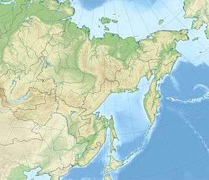
2007 Kuril Islands earthquake
 | |
| Date | 13 January 2007 |
|---|---|
| Origin time | 04:23:20 UTC [1] |
| Magnitude | 8.1 Mw [1] |
| Depth | 5.7 kilometres (4 mi) [1] |
| Epicenter | 46°05′N 154°31′E / 46.08°N 154.51°ECoordinates: 46°05′N 154°31′E / 46.08°N 154.51°E [1] |
| Type | Dip-slip [2] |
| Areas affected |
Kuril Islands Japan |
| Max. intensity | VI (Strong) at Paramushir [3] |
| Tsunami | .32 m (1 ft 1 in) [2] |
The 2007 Kuril Islands earthquake occurred east of the Kuril Islands on 13 January at 1:23 p.m. Japan Standard Time. The shock had a moment magnitude of 8.1 and a maximum Mercalli intensity of VI (Strong). A non-destructive tsunami was generated, with maximum wave amplitudes of .32 meters (1 ft 1 in). The earthquake occurred as a result of normal faulting and was located 95 km to the south east of the 8.3 magnitude 2006 Kuril Islands earthquake which had occurred the previous November.
See also
References
- 1 2 3 4 ISC (2014), ISC-GEM Global Instrumental Earthquake Catalogue (1900–2009), Version 1.05, International Seismological Centre
- 1 2 USGS (4 September 2009), PAGER-CAT Earthquake Catalog, Version 2008_06.1, United States Geological Survey
- ↑ USGS. "M8.1 - east of the Kuril Islands". United States Geological Survey.
- Bibliography
- Lay, T.; Kanamori, H.; Ammon, C. J.; Hutko, A. R.; Furlong, K.; Rivera, L. (2009), "The 2006–2007 Kuril Islands great earthquake sequence" (PDF), Journal of Geophysical Research, American Geophysical Union, 114 (B11), Bibcode:2009JGRB..11411308L, doi:10.1029/2008JB006280
- Rabinovich, A. B.; Lobkovsky, L. I.; Fine, I. V.; Thomson, R. E.; Ivelskaya, T. N.; Kulikov1, E. A. (2008), "Near-source observations and modeling of the Kuril Islands tsunamis of 15 November 2006 and 13 January 2007" (PDF), Advances in Geosciences, European Geosciences Union (14): 105–116, doi:10.5194/adgeo-14-105-2008
This article is issued from Wikipedia - version of the 11/24/2016. The text is available under the Creative Commons Attribution/Share Alike but additional terms may apply for the media files.