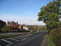
A610 road
The A610 is an A-road in England, which runs from Nottingham to Ambergate, where it joins the A6.[1][2]
Route

The road starts in Nottingham at a roundabout which Maid Marian Way and Upper Parliament Street spur. From here road ascends, passing Nottingham Cathedral. The A610 becomes Alfreton Road as it passes through Hyson Green, then Nuthall road, crossing the Nottingham Ring Road. The road then passes through Aspley, with the speed limit being enforced by average speed cameras. After a roundabout, the road becomes a dual carriageway, ascending out of the city of Nottingham towards another roundabout with the A6002 and B600. Shortly afterwards, the route then meets junction 26 of the M1 motorway at a large roundabout.
After the M1, the route enters a four mile long stretch of dual carriageway, passing Nuthall, Kimberley, Giltbrook and Eastwood to the north, and Awsworth to the south. The road then reverts to a single carriageway at the Derbyshire border, going underneath the junction with the A608. The road then bypasses Langley Mill to the south, and enters Woodlinkin, this particular stretch of the A610 has gained notoriety in the past for road accidents due to the road being particularly windy. The road then ascends into Codnor.
At Codnor, the route turns right at a T-Junction and is relatively straight for around half a mile, then descends and turns sharply left. The road then ascends for a mile, into Ripley until it reaches a roundabout near the Sainsbury's supermarket. Here, the route goes right at the roundabout, left at another roundabout shortly after, then goes straight, passing a McDonald's restaurant on the left, and the Derbyshire Constabulary headquarters on the right. Bypassing Ripley completely, the route reaches a junction with the A38.
After the A38 junction, the road carries on for a mile, passing through Buckland Hollow and Sawmills, with Bullbridge on the right. Finally, the road straddles the River Amber before meeting the A6 at Ambergate.
See also
References
Coordinates: 53°00′42″N 1°18′52″W / 53.01168°N 1.31458°W