Adjumani Airport
| Adjumani Airport | |||||||||||
|---|---|---|---|---|---|---|---|---|---|---|---|
| IATA: none – ICAO: HUAJ | |||||||||||
| Summary | |||||||||||
| Airport type | Public | ||||||||||
| Owner | Adjumani Town Council | ||||||||||
| Serves | Adjumani, Uganda | ||||||||||
| Elevation AMSL | 2,611 ft / 796 m | ||||||||||
| Coordinates | 3°20′20″N 31°45′50″E / 3.33889°N 31.76389°ECoordinates: 3°20′20″N 31°45′50″E / 3.33889°N 31.76389°E | ||||||||||
| Map | |||||||||||
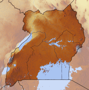
 HUAJ Location of airport in Uganda | |||||||||||
| Runways | |||||||||||
| |||||||||||
Adjumani Airport (ICAO: HUAJ) is an airport that serves the town of Adjumani in the Northern Region of Uganda, close to the international border with South Sudan. It is approximately 376 kilometres (234 mi) by air north of Entebbe International Airport, the country's largest civilian and military airport.[3]
The well-marked runway is 5 kilometres (3.1 mi) southwest of the town. The runway length does not include a 400 metres (1,300 ft) overrun on the western end.
See also
References
External links
This article is issued from Wikipedia - version of the 10/6/2016. The text is available under the Creative Commons Attribution/Share Alike but additional terms may apply for the media files.