Alberta Highway 35
| ||||
|---|---|---|---|---|
| Mackenzie Highway | ||||
 | ||||
| Route information | ||||
| Length: | 465 km (289 mi) | |||
| Major junctions | ||||
| South end: |
| |||
|
| ||||
| North end: |
| |||
| Location | ||||
| Specialized and rural municipalities: | Peace No. 135 M.D., Northern Lights County, Mackenzie County | |||
| Towns: | Manning, High Level | |||
| Highway system | ||||
|
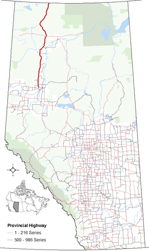
Provincial highways in Alberta
| ||||
.png)
Alberta Provincial Highway No. 35,[1] which forms the majority of Alberta's portion of the Mackenzie Highway, is a north–south highway in northwest Alberta, Canada.
From the south, Highway 35 begins at its intersection with Highway 2, approximately 4 km (2.5 mi) north of the Town of Grimshaw, Alberta and ends at Alberta's boundary with the Northwest Territories. It continues on as Northwest Territories Highway 1. It is one of only two highway-grade roads connecting the NWT with a province (the other being in BC).
Major intersections
From south to north:
| Rural/specialized municipality | Location | km[2] | mi | Destinations | Notes | ||
|---|---|---|---|---|---|---|---|
| Continues as | |||||||
| M.D. of Peace No. 135 | | 0 | 0.0 | ||||
| County of Northern Lights | | 9 | 5.6 | ||||
| | 16 | 9.9 | |||||
| Dixonville | 35 | 22 | |||||
| | 58 | 36 | |||||
| North Star | 72 | 45 | Township Road 910 | ||||
| Manning | 78 | 48 | Passes through Manning. | ||||
| | 116 | 72 | |||||
| | 175 | 109 | South end of Hwy 695 concurrency. | ||||
| | 182 | 113 | North end of Hwy 695 concurrency. | ||||
| Paddle Prairie | 204 | 127 | Unnamed road | Passes through Paddle Prairie Metis Settlement. | |||
| | 215 | 134 | |||||
| Mackenzie County | High Level | 274 | 170 | South end of Hwy 58 concurrency. | |||
| 275 | 171 | North end of Hwy 58 concurrency. | |||||
| Footner Lake | 286 | 178 | |||||
| Meander River | 346 | 215 | Unnamed road | ||||
| | 359 | 223 | Crosses Hay River | ||||
| | 360 | 220 | Zama Road – Zama City | ||||
| Steen River | 421 | 262 | Unnamed road | ||||
| Indian Cabins | 449 | 279 | Unnamed road | ||||
| | 465 | 289 | Alberta – Northwest Territories border (60th parallel) | ||||
| Continues as | |||||||
1.000 mi = 1.609 km; 1.000 km = 0.621 mi
| |||||||
References
- ↑ Provincial Highways Designation Order, Alberta Transportation, p. 6
- ↑ "Google Maps". Google Maps. Retrieved July 14, 2016.
External links
- 2010 Provincial Highways 1 - 216 Series Progress Chart (map, 8 MB) by Alberta Transportation.
- 1948 Mackenzie Highway, Grimshaw to Hay River
This article is issued from Wikipedia - version of the 10/25/2016. The text is available under the Creative Commons Attribution/Share Alike but additional terms may apply for the media files.