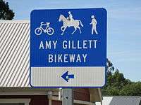
Amy Gillett Bikeway
| Amy Gillett Bikeway | |
|---|---|
|
Amy Gillett Bikeway scene | |
| Established | 2010 |
| Length | 17 km (11 mi) |
| Location | Adelaide Hills, South Australia |
| Trailheads | Oakbank, Mount Torrens |
| Use | Cycling, Hiking, jogging, horse riding |
| Elevation | |
| Elevation change | 114 m (374 ft) |
| Highest point | 498 m (1,634 ft) |
| Lowest point | 371 m (1,217 ft) |
| Grade | gentle |
| Hiking details | |
| Trail difficulty | easy |
| Waymark |
 |
| Surface | asphalt |
| Right of way | Mount Pleasant railway line |
| Website | http://www.adelaidehillsrailtrail.org.au/ |
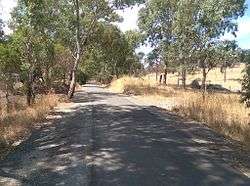
The Amy Gillett Bikeway or Amy Gillett Rail Trail is a shared path in the Adelaide Hills on part of the alignment of the former Mount Pleasant railway line. It is a 17 kilometres (11 mi) sealed path suitable for recreational cycling, walking and horse riding.
Stage 1 was opened in January 2010 by Patrick Conlon, then the South Australian Minister for Transport, Energy and Infrastructure. Stage 1 extended 4 kilometres (2.5 mi) between Oakbank and Woodside.[1] Stage 2 extended it through Charleston[2] and Stage 3 opened in May 2014 added 7 kilometres (4.3 mi) to Mount Torrens.[3] Future work could extend it another 15 kilometres (9.3 mi) through Birdwood to Mount Pleasant. There are also several side loop trails available to interesting destinations off the main path.[4]
References
- ↑ "Amy Gillett Rail Trail (Stage 1) Official Opening (SA)". Rail Trails Australia. Retrieved 8 January 2015.
- ↑ "Adelaide Hills Amy Gillett Rail Trail - Trail Description". Rail Trails Australia. Retrieved 8 January 2015.
- ↑ "Amy Gillett Bikeway - a path to safer cycling". Amy Gillett Foundation. 14 May 2014. Retrieved 8 January 2015.
- ↑ "Adelaide Hills Rail Trail". Adelaide Hills Rail Trail. 2012. Retrieved 8 January 2015.