Angakauitai
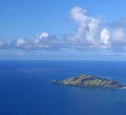 Angakauitai Island | |
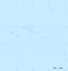  Angakauitai | |
| Geography | |
|---|---|
| Location | Pacific Ocean |
| Coordinates | 23°9′55″S 135°2′6″W / 23.16528°S 135.03500°WCoordinates: 23°9′55″S 135°2′6″W / 23.16528°S 135.03500°W |
| Archipelago | Tuamotus |
| Area | 0.7 km2 (0.27 sq mi) |
| Highest elevation | 139 m (456 ft) |
| Highest point | (unnamed) |
| Administration | |
|
France | |
| Overseas collectivity | French Polynesia |
| Administrative subdivision | Tuamotus |
| Commune | Gambier Islands |
| Demographics | |
| Population | Uninhabited[1] (2012) |
Angakauitai is an island of the Gambier Islands of French Polynesia.[2] It has an area of 0.7 km2 and its highest point is at 139 m. It is administratively part of the Gambier Islands. It is uninhabited.
References
- ↑ "Population". Institut de la statistique de la Polynésie française. Retrieved 23 September 2014.
- ↑ Memoirs of the New York Botanical Garden: "A smaller island, Angakauitai, appears to the southeast of Taravai."
 Tuamotus  Gambiers | Islands/Atolls: |  | |
|---|---|---|---|
| Island groups: | |||
This article is issued from Wikipedia - version of the 11/11/2016. The text is available under the Creative Commons Attribution/Share Alike but additional terms may apply for the media files.