Arbing
| Arbing | ||
|---|---|---|
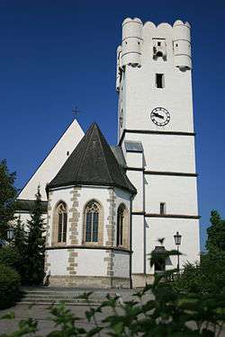 | ||
| ||
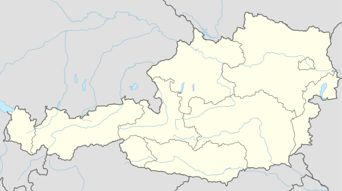  Arbing Location within Austria | ||
| Coordinates: 48°13′39″N 14°42′27″E / 48.22750°N 14.70750°ECoordinates: 48°13′39″N 14°42′27″E / 48.22750°N 14.70750°E | ||
| Country | Austria | |
| State | Upper Austria | |
| District | Perg | |
| Government | ||
| • Mayor | Josef Hiesböck (ÖVP) | |
| Area | ||
| • Total | 12,01 km2 (464 sq mi) | |
| Elevation | 278 m (912 ft) | |
| Population (1 January 2016)[1] | ||
| • Total | 1,435 | |
| • Density | 1.2/km2 (3.1/sq mi) | |
| Time zone | CET (UTC+1) | |
| • Summer (DST) | CEST (UTC+2) | |
| Postal code | 4341 | |
| Area code | 07269 | |
| Vehicle registration | PE | |
| Website | www.arbing.at | |

Arbing is a municipality in the district Perg in the Austrian state of Upper Austria.
Geography
Arbing is located in the lower Mühlviertel at the transition from the fertile hills of the Mühlviertel Machlande level of the Danube. The extension is 4.4 kilometers from north to south, from west to east is also 4.4 kilometers. The total area is 12 square kilometers. 17.5 percent of the area is forested, 71.7 percent of the area are used for agriculture. Quarters are: Arbing, Frühstorf, Groißing, Hummelberg, Puchberg in Machland, Roisenberg. Some parts of other villages also belong to the municipality Arbing (Mollnegg, Hehenberger)
Population
| Historical population | ||
|---|---|---|
| Year | Pop. | ±% |
| 1869 | 950 | — |
| 1880 | 983 | +3.5% |
| 1890 | 997 | +1.4% |
| 1900 | 943 | −5.4% |
| 1910 | 948 | +0.5% |
| 1923 | 941 | −0.7% |
| 1934 | 896 | −4.8% |
| 1939 | 1,082 | +20.8% |
| 1951 | 910 | −15.9% |
| 1961 | 987 | +8.5% |
| 1971 | 1,073 | +8.7% |
| 1981 | 1,149 | +7.1% |
| 1991 | 1,269 | +10.4% |
| 2001 | 1,284 | +1.2% |
| 2009 | 1,374 | +7.0% |
| 2015 | 1,397 | +1.7% |
References
External links
 |
Wikimedia Commons has media related to Arbing. |
This article is issued from Wikipedia - version of the 9/16/2015. The text is available under the Creative Commons Attribution/Share Alike but additional terms may apply for the media files.