Bacombe and Coombe Hills
| Site of Special Scientific Interest | |
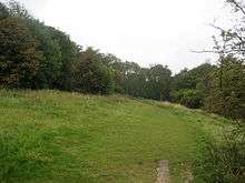
 Ridgeway on Bacombe Hill | |
| Area of Search | Buckinghamshire |
|---|---|
| Grid reference | SP852068 |
| Interest | Biological |
| Area | 76.4 hectares |
| Notification | 1999 |
| Location map | Magic Map |
Bacombe and Coombe Hills is a 76.4 hectare biological Site of Special Scientific Interest in Upper Bacombe in Buckinghamshire.[1][2] Bacombe Hill was formerly owned by Buckinghamshire County Council, which transferred it to Berkshire, Buckinghamshire and Oxfordshire Wildlife Trust in 2014.[3][4] Coombe Hill is owned by the National Trust.[5]
The site is in the Chilterns Area of Outstanding Natural Beauty[6] and Bacombe Hill is a Local Nature Reserve.[7][8] The Ridgeway National Trail crosses the site.[6]
The site is chalk grassland which has a rich variety of species. including the entire British population of fringed gentian, and there are areas of juniper and mixed scrub. Invertebrates include scarce species, such as chalkhill blue and brown argus butterflies.[1] Bacombe Hill is noted for orchids.[7]
There is access from Ellesbrough Road.[6]
References
- 1 2 "Bacombe and Coombe Hills citation" (PDF). Sites of Special Scientific Interest. Natural England. Retrieved 4 January 2015.
- ↑ "Map of Bacombe and Coombe Hills". Sites of Special Scientific Interest. Natural England. Retrieved 4 January 2015.
- ↑ "Officer Executive Decision - Divestment of land at Bacombe Hill to Berkshire, Buckinghamshire & Oxfordshire Wildlife Trust" (PDF). Buckinghamshire County Council. 5 October 2014.
- ↑ "COMMUNITY WILDLIFE OFFICER (BUCKS)" (PDF). Berkshire, Buckinghamshire & Oxfordshire Wildlife Trust. Retrieved 28 September 2015.
- ↑ "Chilterns Countryside". National Trust. Retrieved 28 September 2015.
- 1 2 3 "Bacombe Hill Local Nature Reserve". Chilterns Conservation Board. Retrieved 4 January 2015.
- 1 2 "Bacombe Hill". Local Nature Reserves. Natural England. 8 August 2013. Retrieved 4 January 2015.
- ↑ "Map of Bacombe Hill". Local Nature Reserves. Natural England. Retrieved 4 January 2015.
External links
- "Bacombe Hill". Berkshire, Buckinghamshire and Oxfordshire Wildlife Trust.
Coordinates: 51°45′12″N 0°46′02″W / 51.7534°N 0.7671°W