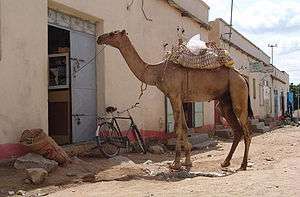
Barentu, Eritrea
| Barentu ባረንቱ | |
|---|---|
 | |
 Barentu Map of Barentu in Eritrea | |
| Coordinates: 15°07′00″N 37°36′00″E / 15.11667°N 37.60000°E | |
| Country | Eritrea |
| Time zone | EAT (UTC+3) |
Barentu (Tigrinya: ባረንቱ? Tigrinya pronunciation: [barɐntu]) is a town in south-western Eritrea, lying south of Agordat on the continent of Africa. It was mainly inhabited by the Nilotic Kunama people and Nara people in the past. The Nara people leader Shekaray Agaba was the first to build the town umba arenku which it means the white water. It is located in the Gash-Barka Zone of Eritrea. Barentu is the largest town in the Gash-Barka Zone in Eritrea, lying west of Asmara. It is the capital of the Gash-Barka and home of the Nara and Kunama tribe. The city is integrated with different types of tribes; Kunama, Nara, Tigre and Tigrigna being the dominant. Its climate is semi-desert warm during summer and cold during winter. It is one of the fastest growing cities in the country. It acts as a hub for the surrounding agricultural areas, as a center for trade and exchange of commodities owing to its location in the center of the Gash Barka region.

The town has typically been a center of mining and agricultural activities for the area. As part of the Eritrean-Ethiopian War of 1998-2000, the then flourishing town suffered major damage but has since undergone reconstruction. Thus it now attracts settlers from all parts of the country especially from the Gash area and the Eritrean highlands. Owing to this factor the town has expanded rapidly in the last decade. This rapid expansion is also partly attributed to the Eritrean returnees from the Sudan who established their home in the town after years of migration spent in the Sudan. The Town of Barentu is not only grown fast but it is also developing with the scale, and it have been able to provide basic services, such transport, education, health facilities and all that coupled with a fine weather which render the town to be one with a bright future. The town of Barentu is rich in cultural and social heritages, which will definitely one day make it a tourist site. The town consists of 3 administrative regions or zobas (as they are called in tigrigna) namely zoba Fthi [ፍትሒ], Selam [ሰላም] and Biara [ቢያራ]. Nearby towns and villages include Tauda (14.8 km or 8.0 nmi), Alegada (12.8 km or 6.9 nmi), Dedda (13.3 km or 7.2 nmi), Augana (5.9 km or 3.2 nmi), Cona (10.6 km or 5.7 nmi) and Daghilo (14.4 km or 7.8 nmi), Mogolo, kofa arenku, Arada Tarkina, Lemesa.
References
External links
-
 Media related to Barentu at Wikimedia Commons
Coordinates: 15°07′N 37°36′E / 15.117°N 37.600°E