Batang Hari Regency
| Batang Hari Regency (Kabupaten Batang Hari) | ||
|---|---|---|
| Regency | ||
| ||
 | ||
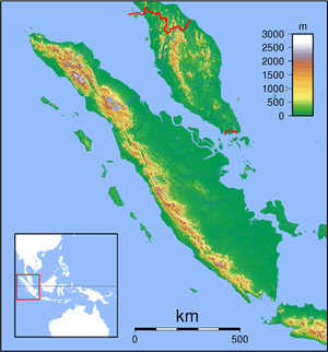
 Batang Hari Regency Location in Sumatra | ||
| Coordinates: 2°1′S 103°20′E / 2.017°S 103.333°E | ||
| Country | Indonesia | |
| Province | Jambi | |
| Capital | Muara Bulian | |
| Area | ||
| • Total | 5,804 km2 (2,241 sq mi) | |
| Population (2014) | ||
| • Total | 266,323 | |
| • Density | 46/km2 (120/sq mi) | |
| Time zone | WIB (UTC+7) | |
| Website | http://www.batangharikab.go.id/ | |
Batang Hari is a regency of Jambi Province in Sumatra, Indonesia. It had a population of 241,334 at the 2010 Census;[1] the latest official estimate (as at January 2014) was 266,323. It covers an area of 5,804 km².
Administrative districts
The Regency is split administratively into eight districts (kecamatan):
- Bajubang
- Batin XXIV
- Maro Sebo Ilir
- Maro Sebo Ulu
- Mersam
- Muara Bulian
- Muara Tembesi
- Pemayung
Towns and villages
- Muara Bulian - regency capital
- Paalmerah
- Talang Pelempang
- Pinangtinggi
- Bejubang
- Tempino
- Talang Gudang
- Muara Bahar
References
- ↑ Biro Pusat Statistik, Jakarta, 2011.
External links
Coordinates: 2°01′00″S 103°19′59″E / 2.01667°S 103.333°E
This article is issued from Wikipedia - version of the 6/14/2016. The text is available under the Creative Commons Attribution/Share Alike but additional terms may apply for the media files.
