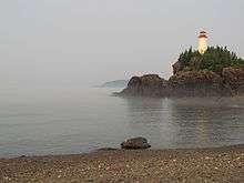
Battle Island Light
 Battle Island Lighthouse | |
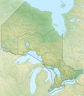 Ontario | |
| Location | Battle Island, Ontario |
|---|---|
| Coordinates | 48°45′06.5″N 87°33′26.4″W / 48.751806°N 87.557333°WCoordinates: 48°45′06.5″N 87°33′26.4″W / 48.751806°N 87.557333°W |
| Year first constructed | 1877 (first) |
| Year first lit | 1911 (current) |
| Automated | 1991 |
| Construction |
wooden-frame (first) poured concrete tower (current) |
| Tower shape | tapered octagonal tower with balcony and lantern |
| Markings / pattern | white tower, red lantern |
| Height | 43 feet (13 m) |
| Focal height | 117 feet (36 m) |
| Range | 18 miles (29 km) |
| Characteristic | Fl (3) W 24s. |
| CHS number | CCG 1117 |
| ARLHS number | CAN-547 |
| USCG number | 7-16870 |
| Managing agent | Canadian Coast Guard[1] |
Battle Island Light is a lighthouse on the Canadian shore of Lake Superior. It is located on the westerly point of Battle Island, 28.5 miles (45.9 km) east-northeast from Lamb Island Light. It was built as a white light, visible for 18 miles (29 km) in clear weather. When built, it operated as a bright flash, four-second interval, bright flash, four-second interval, and then bright flash, 16-second interval, with a concurrent lower-strength light operating at 12-seconds constant/ 12 seconds eclipsed. Its fog horn (originally referred to as a "fog diaphone") blasted for 3½ seconds and was then silent for 26½ seconds.[2] The lighthouse was rebuilt in 1915-16 in response to increased demand from local wood pulp carriers and commercial fishing boats.
See also
References
- ↑ Rowlett, Russ. "Lighthouses of Canada: Western Ontario". The Lighthouse Directory. University of North Carolina at Chapel Hill. Retrieved January 4, 2016.
- ↑ U.S. Lake Survey (1916). "Lake Superior". Bulletin no. 25: survey of northern and western lakes. Detroit, MI: U.S. Lake Survey Office. p. 99.
External links
- Aids to Navigation Canadian Coast Guard