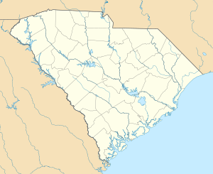
Battle of Hanging Rock Historic Site
|
Battle of Hanging Rock Historic Site | |
|
Battle marker Hanging Rock, April 2008 | |
  | |
| Location | About 3.5 miles south of Heath Springs off U.S. Route 521, near Heath Springs, South Carolina |
|---|---|
| Coordinates | 34°33′31″N 80°39′54″W / 34.55861°N 80.66500°WCoordinates: 34°33′31″N 80°39′54″W / 34.55861°N 80.66500°W |
| Area | 370 acres (150 ha) |
| Built | 1780 |
| NRHP Reference # | 74001860[1] |
| Added to NRHP | December 31, 1974 |
Battle of Hanging Rock Historic Site is a historic battle site commemorating the Battle of Hanging Rock during the American Revolutionary War and located near Heath Springs, Lancaster County, South Carolina. As part of a series of strongholds planned to maintain the British position in South Carolina, an outpost was established at Hanging Rock in 1780. The importance of this post was in its strategic location on the road from Camden to Charlotte. The first American attack on the post occurred on July 30, 1780, led by Major William Richardson Davie, with 40 dragoons and 40 mounted riflemen. On August 6, 1780, and after three hours of fighting, many of General Thomas Sumter’s men were unable to continue the battle. It was agreed to plunder the British camp and depart.[2][3]
It was added to the National Register of Historic Places in 1974.[1]
References
- 1 2 National Park Service (2010-07-09). "National Register Information System". National Register of Historic Places. National Park Service.
- ↑ John Califf, III (October 1974). "Battle of Hanging Rock Historic Site" (pdf). National Register of Historic Places - Nomination and Inventory. Retrieved June 2014. Check date values in:
|access-date=(help) - ↑ "Battle of Hanging Rock Historic Site, Lancaster County (off U.S. Hwy. 521, Heath Springs vicinity)". National Register Properties in South Carolina. South Carolina Department of Archives and History. Retrieved June 2014. Check date values in:
|access-date=(help)

