Bauraha khola
[1] http://wikimapia.org/17587881/bauraha-kholaBauraha khola.
-

Bauraha khola
Bauraha khola[2] (बौराहा खोला)

,[3] Buraha فتح,
bauraha開か,
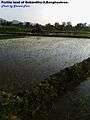
bauraha খোলা,₪ sometimes Baulaha khola(बौलाहा खोला)↑₪↑ is a stream located in Gobardiya[4] VDC in Dang Deukhuri District Nepal. It irrigates the land of Banghushree 12 months. Water level rises in monsoon season. It runs from south to north between banghushree and badahara village, originating from southern Chure hills of BanghushreeDang Deukhuri District Nepal which is near around place of Bauraha such as saani Bauraha, Thulo Bauraha, Kalyankot, Domai,Gangare, Gogan paani etc. which are places of Kapilvastu district. Many other down streams such as Chureni khola,Sota, Bhutaiya khola Bagaiya khola mix in Bauraha khola. Sanghuri।सॉघुरी। is a place where stream accumulates its strengths which is the place of vertical slope with narrow opening. In the time of monsoon season, it causes huge loss of property. Upper large catchment area where high precipitation in monsoon season results devastating flash flood each year which turns into nightmare for the locals of Banghushree. Bauraha khola, which generally carries mud, boulders and lots of debris due to steep slope, sweeps fertile land of Banghushree each year. It ends its presence by mixing with West Rapti River near at Banghushree. Both Damodar road and Dulaiya road, crosses Bauraha khola to connect Banghushree with Badahara village. There is no any solid infrastructure built to cross the stream Bauraha khola.
In 2018 B.S.(1961 A.D.), Huge flooding in Bauraha Khola caused huge loss of livestock and property. Which was the very devastating flood ever recorded. At that time, Stream modified the lower lands near Banghushree and Badahara. The lonely peak or ekal danda was the result of that flood.
Location
Gobardiya VDC Dang Deukhuri District Nepal. It is 4 km west from Kalakate.
Affected villages
- Banghushree
- Banbari
- Badahara
- Bauraha
Swept areas
- Putali danda and nearby agricultural lands
- western majhaghat and nearby lands of national forest
- west part of Banghushree
- Khaireni
Affected roads
- Damodar road
- Dulaiya road
- Banghushree Banbari local footpath
References
- ↑ Bruins, B.; Heijmans A. (1993). "Gender biases in irrigation projects". Gender consideration of rehabilitation of Bauraha irrigation system in the district of Dang, Nepal. Kathmandu, Nepal: Mimeo.
- ↑ http://wikimapia.org/17587881/bauraha-khola
- ↑ https://commons.wikimedia.org/wiki/File:Bauraha_khola.ogg
- ↑ "Nepal Census 2011". Nepal's Village Development Committees. Digital Himalaya. Retrieved 21 September 2008.