Bear Creek Spire
| Bear Creek Spire | |
|---|---|
 Bear Creek Spire | |
| Highest point | |
| Elevation | 13,726 ft (4,184 m) [1] |
| Prominence | 1,440 ft (440 m) [1] |
| Coordinates | 37°22′05″N 118°46′03″W / 37.368012°N 118.767505°WCoordinates: 37°22′05″N 118°46′03″W / 37.368012°N 118.767505°W [1] |
| Geography | |
| Location |
Inyo County, California, United States |
| Parent range | Sierra Nevada |
| Topo map | USGS Mount Hilgard |
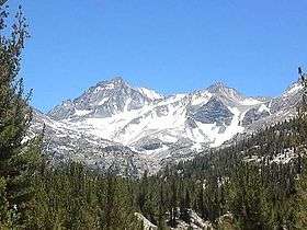
Bear Creek Spire is located in the Sierra Nevada in Inyo County in eastern California in the southwestern United States [1] and is the 46th highest mountain in California and the 225st highest mountain in the United States.[2] Bear Creek Spire is part of the John Muir Wilderness and the Inyo National Forest.[1]
History

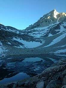
Bear Creek Spire from Dade Lake

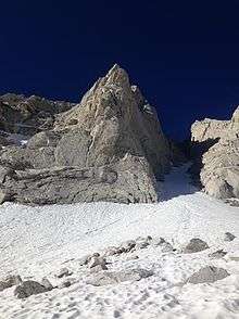
On the approach from Dade Lake to the East Arete of Bear Creek Spire
Bear Creek Spire was named in 1908 by Joseph LeConte, James Hutchinson and Duncan McDuffie, because of its position at the head of the Hilgard Branch of Bear Creek.[3]
Climbing
The first ascent of Bear Creek Spire was a solo climb by Hermann Ulrichs in 1923 up its west face.[3][4] Norman Clyde established the Northeast Face route in October 1931 and a route up the Northeast Buttress in May 1932.[3]
References
- 1 2 3 4 5 "Bear Creek Spire, California". peakbagger.com. peakbagger.com. Retrieved October 13, 2014.
- ↑ "Bear Creek Spire". http://peakery.com. Retrieved October 13, 2014. External link in
|website=(help) - 1 2 3 "Bear Creek Spire". Retrieved October 13, 2014.
- ↑ "Scrambles on Bear Creek Spire, Sierra Nevada (First Ascent from the East)". http://publications.americanalpineclub.org. Retrieved October 13, 2014. External link in
|website=(help)
This article is issued from Wikipedia - version of the 12/6/2015. The text is available under the Creative Commons Attribution/Share Alike but additional terms may apply for the media files.