Bertoua
| Bertoua | |
|---|---|
|
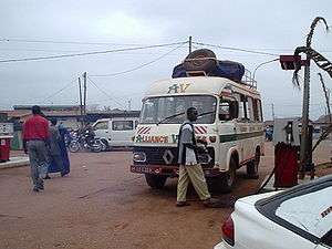
Petrol station near the gare routière in Bertoua | |
 Bertoua Location in Cameroon | |
| Coordinates: 4°35′N 13°41′E / 4.583°N 13.683°E | |
| Country |
|
| Region | East Region |
| Founded | 1927 |
| Area | |
| • Total | 100 km2 (40 sq mi) |
| Elevation | 717 m (2,352 ft) |
| Population (2005)census | |
| • Total | 88,462 |
| • Density | 880/km2 (2,300/sq mi) |
| Climate | Aw |
Bertoua is the capital of the Eastern Region of Cameroon and of the Lom-et-Djerem Department. It has a population of 88,462 (at the 2005 Census), and is the traditional home of the Gbaya people. It is home to an airport and Mission Cameroon (in Polish: Misja Kamerun) of Polish Dominican Order.
In 2014, the hospital in Bertoua became known for its work serving the medical needs of refugees from the Central African Republic crossing into Cameroon at border towns such as Gbiti.[1][2]
References
- ↑ Schmitt, Celine (2014-06-06). "Central African Republic: Rapid Treatment Saves Seven-Year-Old CAR Refugee Chopped and Left for Dead (Page 1 of 2)". allAfrica.com. Retrieved 2014-06-10.
- ↑ Schmitt, Celine (2014-05-23). "Growing numbers of young CAR refugees arrive in Cameroon with malnutrition". The Cameroon Daily Journal. Retrieved 2014-06-10.
External links
Coordinates: 4°35′N 13°41′E / 4.583°N 13.683°E
This article is issued from Wikipedia - version of the 10/31/2016. The text is available under the Creative Commons Attribution/Share Alike but additional terms may apply for the media files.
