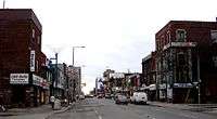
Bloordale Village

Bloordale Village is a neighbourhood in Toronto that is located along Bloor Street from Lansdowne Avenue to Dufferin Street, west of downtown in Toronto, Ontario, Canada. It sits on the southern border of the Wallace Emerson neighbourhood and the northern border of the Brockton Village neighbourhood. The district is home to a mix of shopping, bars and art galleries.
A similarly named neighbourhood is Bloordale Park, located in the former city of Etobicoke, Ontario, west of Highway 427, and bounded roughly by Rathburn Road, the Elmcrest Creek, and Dundas St.
Character
Bloordale Village (commonly known as Bloordale) has undergone significant change in recent years, and is now considered one of Toronto's 'up and coming' art districts.[1][2] The area is the location of Mercer Union Centre for Contemporary Art and Toronto Free Gallery. On Oct 23rd, 2013 the Bloordale Community Improvement Association was formed. In 2016 the BIA launched a new website and social media initiative at www.discoverbloordale.com.
The strip along Bloor Street also has a large number of small restaurants and retail outlets. At Dufferin Street, the south side of the street is used by Bloor Collegiate Institute. The surrounding area is a highly diverse, mixed-income community.[3] A mix of Portuguese, Caribbean, Italian, Bangladeshi, Latin American, Pakistani, Sri Lankan, Burmese, Chinese, and Vietnamese populations are found in the neighbourhood. At one local primary school, 81 per cent of students speak a native language other than English.[4]
References
- ↑ "West-End Pearls". National Post. November 22, 2008. Retrieved 2009-03-10.
- ↑ Whyte, Murray (October 5, 2008). "Bloordale Gentrified: West Queen West's art moves north". Toronto Star. Retrieved 2009-03-11.
- ↑ Mathieu, Emily (June 5, 2008). "An unpretentious, friendly spirit". Toronto Star. Retrieved 2009-03-11.
- ↑ "globeandmail.com: Bloordale Village". The Globe and Mail.
External links
- The Bloordale Village BIA (Business Improvement Area)
- Bloordale Community Improvement Association
- BlogTO's Bloordale Directory
 |
Wallace Emerson | Dovercourt Park |  | |
| Junction Triangle | |
Bloorcourt Village | ||
| ||||
| | ||||
| Brockton |
Coordinates: 43°39′32″N 79°26′20″W / 43.659°N 79.439°W