Magugpo East
Briz District, also known as Barangay Magugpo East, is a district of Tagum City in the Philippines.
Majority of the residents are descendants of Don Ricardo Briz, the post-Spanish era settlers in the area.
History
Briz District was first settled by native Mansakas of Magugpo Poblacion. In the 1900s, Cebuano-Spanish Mestizo Don Ricardo Briz and wife Doña Felisa Verallo Briz with their 10 children (Maria married to Bonifacio Senangote, Lucrecia married to Elias Senangote, Monica married to Nazario Morata, Florencia married to Leodegario Crisostomo, Isabel married to Nemecio Mantilla, Marcelina married to Nicolas Cuyacot, Camilo married to Acme Cervantes, Adriana married to Asari Jawaddin, Ladislao married to Vicenta and Tecla married to Romeo Perote) migrated to Tagum from Cebu and bought a portion of land from the Mansakas to be the sole owner of the 29-hectare-land until the 1920s. Now, Briz District, is subdivided and owned by several people but not limited to the descendants of Don Ricardo Briz.
In the late 1960s, Doña Felisa Verallo Briz and her children donated one hectare of the land to build public school buildings. In honor of the late patriarch, the school was named after him as the Don Ricardo Briz Central Elementary School.
Later, a street was likewise named after him, the Don Ricardo Briz Street.
Demographics
Briz District was once a residential area but is now considered commercial. Several huge commercial buildings like Gaisano Mall were built within the District which boosts tourism in the place.
The barangay Magugpo East Area has a population of 16,136 in 3,227 Households. Magugpo East consist 1.3%Land Area Of Tagum City. It is approximately 2.00 km from city hall.
| Barangay Classification | Urban Barangay |
|---|---|
| Means of Transportation | Pedicab, Jeepneys, Motorcycle |
| Water Sources | Tagum Water District |
| Power Sources | Daneco-NEA |
| Fiesta | Last Sunday Of November |
| Araw Celebration | September 20 |
Location
Kilometer 55,Tagum National Highway, Brgy. Magugpo East, Tagum City, Davao del Norte, Philippines
Gallery
-
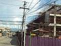
Entrance(2010)
-

Gaisano Mall In Briz District
-

Ricardo Briz Street
External links
- http://www.philippinecompanies.com/town.php?town=Tagum%20City&prov=Davao%20del%20Norte
- http://www.philippinecompanies.com/companyprofile/54235/liceo-de-davao
- http://wikimapia.org/#lat=7.4528583&lon=125.8183908&z=15&l=0&m=b&v=1
- http://www.tagumcity.gov.ph/barangay_profile/BrgyMap_Links/MagEast/mageast.html
Coordinates: 7°26′48″N 125°48′44″E / 7.44667°N 125.81222°E