Buache Peak
Buache Peak (Bulgarian: връх Бюаш, ‘Vrah Buache’ \'vr&h byu-'ash\) is the mostly ice-covered peak rising to 600 m on Two Hummock Island in the Palmer Archipelago, Antarctica. The feature has precipitous and partly ice-free west-northwest slopes, and is one of the two ‘hummocks’ that gave the name of the island.
The peak is named after the French cartographer Philippe Buache (1700-1773) who published maps of the south polar region in 1739 and 1754.
Location
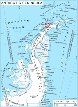
Buache Peak is located at 64°08′20″S 61°43′38″W / 64.13889°S 61.72722°WCoordinates: 64°08′20″S 61°43′38″W / 64.13889°S 61.72722°W, which is 1.63 km southwest of Modev Peak, 4.8 km northwest of Veyka Point and 1.93 km northeast of Palaver Point. British mapping in 1978.
Maps
- British Antarctic Territory. Scale 1:200000 topographic map. DOS 610 Series, Sheet W 64 60. Directorate of Overseas Surveys, UK, 1978.
- Antarctic Digital Database (ADD). Scale 1:250000 topographic map of Antarctica. Scientific Committee on Antarctic Research (SCAR). Since 1993, regularly upgraded and updated.
References
- Bulgarian Antarctic Gazetteer. Antarctic Place-names Commission. (details in Bulgarian, basic data in English)
- Buache Peak. SCAR Composite Antarctic Gazetteer.
This article includes information from the Antarctic Place-names Commission of Bulgaria which is used with permission.