Canaan Street Historic District
|
Canaan Street Historic District | |
 | |
  | |
| Location | Canaan St., Canaan, New Hampshire |
|---|---|
| Coordinates | 43°39′56″N 72°02′32″W / 43.6656°N 72.0422°WCoordinates: 43°39′56″N 72°02′32″W / 43.6656°N 72.0422°W |
| Area | 24 acres (9.7 ha) |
| Architectural style | Greek Revival, Federal |
| NRHP Reference # | 73000163[1] |
| Added to NRHP | May 7, 1973 |
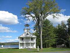
The Canaan Street Historic District of Canaan, New Hampshire encompasses the original center of the town, running along Canaan Street roughly from Prospect Hill Street in the north to Moses Flower Lane in the south. The town was established by a land grant in 1761, but "Broad Street", its principal road, was not laid out until 1788. Because it was on a major north-south stagecoach route, the area developed in the first half of the 19th century as a trading center. The old town hall was built in the 1790s to serve as a church, and was joined by institutional buildings including the 1828 Greek Revival Old North Church and the 1839 Academy (now the town library and museum). Most of the residential houses in the district are Federal and Greek Revival in styling. The area declined in economic importance because it was bypassed by the railroad, but was developed as a summer resort community in the second half of the 19th century, rivaling Bethlehem.[2]
The district was listed on the National Register of Historic Places in 1973.[1]
See also
References
- 1 2 National Park Service (2010-07-09). "National Register Information System". National Register of Historic Places. National Park Service.
- ↑ "NRHP nomination for Canaan Street Historic District" (PDF). National Park Service. Retrieved 2014-03-23.
| Topics |  | |
|---|---|---|
| Lists by county | ||
| Other lists | ||
| ||