Chamarajapuram, Mysore
| Chamarajapuram K.G.Koppal | |
|---|---|
 | |
| Coordinates: 12°18′01″N 76°38′27″E / 12.30034°N 76.64080°ECoordinates: 12°18′01″N 76°38′27″E / 12.30034°N 76.64080°E | |
| Country |
|
| State | Karnataka |
| District | Mysore |
| Time zone | IST (UTC+5:25) |
| PIN | 570005[1] |
Chamarajapuram or K.G.Koppal is a major suburb of Mysore city in Karnataka province of India. The locality is named after king Chamarajendra Wadiyar because the suburb was planned during his rule. [2]
Alternate Names
Chamarajapuram is also called by alternate names like
- Jayanagar
- K.G.Koppal
Important Landmarks
- Ashokapuram Police Station
- Appollo Hospital
- K.G.Koppal Market
- Akshay Bhandar Junction
- Underbridge junction
- Chamarajapuram Railway Station
- Old district court complex
- New district court complex
Image Gallery
-
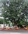
Underbridge at K.G.Koppal
-
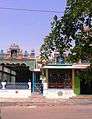
K.G.Koppal temple
-
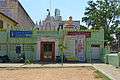
Digambar Jain Temple
See also
References
This article is issued from Wikipedia - version of the 10/13/2016. The text is available under the Creative Commons Attribution/Share Alike but additional terms may apply for the media files.