Charlestown, Derbyshire
| Charlestown | |
 |
|
 Charlestown |
|
| District | High Peak |
|---|---|
| Shire county | Derbyshire |
| Region | East Midlands |
| Country | England |
| Sovereign state | United Kingdom |
| Post town | Glossop |
| Postcode district | SK13 |
| EU Parliament | East Midlands |
|
|
Coordinates: 53°25′57″N 1°57′01″W / 53.4326°N 1.9504°W
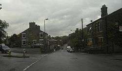
Charlestown is a village in Glossopdale, Derbyshire, England.[1][2] At the 2011 Census the population was included in the Simmondley Ward of the High Peak District Council. The village is situated on the A624 road between Glossop and Hayfield.
References
- ↑ Ordnance Survey: Landranger map sheet 110 Sheffield & Huddersfield (Glossop & Holmfirth) (Map). Ordnance Survey. 2012. ISBN 9780319231876.
- ↑ "Ordnance Survey: 1:50,000 Scale Gazetteer" (csv (download)). www.ordnancesurvey.co.uk. Ordnance Survey. 1 January 2016. Retrieved 30 January 2016.
This article is issued from Wikipedia - version of the 8/4/2016. The text is available under the Creative Commons Attribution/Share Alike but additional terms may apply for the media files.