Colorado State Highway 330
| ||||
|---|---|---|---|---|
|
Map of Mesa County in western Colorado with SH 330 highlighted in red | ||||
| Route information | ||||
| Maintained by CDOT | ||||
| Length: | 11.395 mi[1] (18.338 km) | |||
| Location | ||||
| Counties: | Mesa | |||
| Highway system | ||||
|
Colorado State Highways
| ||||

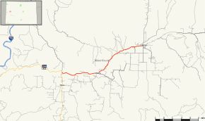


State Highway 330 is a highway in Mesa County, Colorado.
Route description
SH 330 runs 11.4 miles (18.3 km), starting at a junction with State Highway 65, heading east past Molina and ending at Grove Creek Rd. in Collbran.
Major intersections
The entire route is in Mesa County.
| Location | mi | km | Destinations | Notes | |
|---|---|---|---|---|---|
| | 0.000 | 0.000 |  SH 65 SH 65 | ||
| Collbran | 11.395 | 18.338 | Grove Creek Road | ||
| 1.000 mi = 1.609 km; 1.000 km = 0.621 mi | |||||
References
- ↑ "Segment list for SH 330". Retrieved 2011-01-22.
External links
This article is issued from Wikipedia - version of the 2/6/2016. The text is available under the Creative Commons Attribution/Share Alike but additional terms may apply for the media files.