Colorado State Highway 93
| ||||
|---|---|---|---|---|
|
Map of north central Colorado with SH 93 highlighted in red | ||||
| Route information | ||||
| Maintained by CDOT | ||||
| Length: | 18.849 mi[1] (30.335 km) | |||
| Major junctions | ||||
| South end: |
  US 6 / SH 58 in Golden US 6 / SH 58 in Golden | |||
| North end: |
  SH 7 / SH 119 in Boulder SH 7 / SH 119 in Boulder | |||
| Location | ||||
| Counties: | Jefferson, Boulder | |||
| Highway system | ||||
|
Colorado State Highways
| ||||

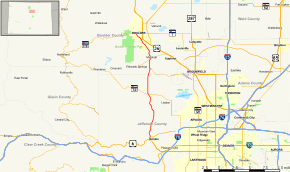


State Highway 93 is a highway in Colorado that connects Golden and Boulder.
Route description
SH 93 runs 18.8 miles (30.3 km), starting at its southern junction with U.S. Highway 6 at the entrance to Clear Creek Canyon in Golden. It runs north, just east of the mountains, ending at a junction with SH 119 in central Boulder.
Major intersections
| County | Location | mi | km | Destinations | Notes |
|---|---|---|---|---|---|
| Jefferson | Golden | 0.000 | 0.000 | US 6 / SH 58 east to SH 119 – Denver, Idaho Springs, Black Hawk, Central City | |
| Arvada | 7.573 | 12.188 |  SH 72 – Pinecliffe, Arvada SH 72 – Pinecliffe, Arvada | ||
| Boulder | | 11.781 | 18.960 |  SH 128 east – Broomfield, Rocky Mountain Metro Airport SH 128 east – Broomfield, Rocky Mountain Metro Airport | |
| | 13.632 | 21.939 |   SH 170 to US 36 – Eldorado Springs, Marshall, Eldorado Canyon State Park SH 170 to US 36 – Eldorado Springs, Marshall, Eldorado Canyon State Park | ||
| Boulder | 17.422 | 28.038 | Baseline Road (SH 36E east) | ||
| 18.849 | 30.335 | SH 119 (Canyon Boulevard) / Broadway – Lyons, Nederland, Lafayette | |||
| 1.000 mi = 1.609 km; 1.000 km = 0.621 mi | |||||
References
- ↑ "Segment list for SH 93". Retrieved 2011-01-19.
External links
This article is issued from Wikipedia - version of the 9/11/2016. The text is available under the Creative Commons Attribution/Share Alike but additional terms may apply for the media files.