Congerstone
| Congerstone | |
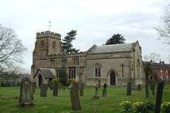 Saint Mary Parish Church |
|
 Congerstone |
|
| OS grid reference | SK3605 |
|---|---|
| Shire county | Leicestershire |
| Region | East Midlands |
| Country | England |
| Sovereign state | United Kingdom |
| Postcode district | CV13 |
| Police | Leicestershire |
| Fire | Leicestershire |
| Ambulance | East Midlands |
| EU Parliament | East Midlands |
|
|
Coordinates: 52°38′N 1°28′W / 52.64°N 01.46°W
Congerstone is a small settlement in Leicestershire, England.[1] It is near the Ashby-de-la-Zouch Canal and the A444 road.
External links
References
- ↑ OS Explorer Map 232 : Nuneaton & Tamworth: (1:25 000) :ISBN 0 319 46404 0
This article is issued from Wikipedia - version of the 1/23/2016. The text is available under the Creative Commons Attribution/Share Alike but additional terms may apply for the media files.