Crafthole
| Crafthole | |
|---|---|
| village | |
 | |
| Coordinates: 50°21′54″N 4°18′00″W / 50.365°N 4.300°WCoordinates: 50°21′54″N 4°18′00″W / 50.365°N 4.300°W | |
| Country | England |
| County | Cornwall |
| Civil parish | Sheviock |
| Postcode | PL11 |
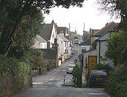
Crafthole is a village in the parish of Sheviock, Cornwall, England.[1][2]
The village has a post office, inn and chapels; there is a golf course nearby.[3]
References
Cornwall Portal | |
| Unitary authorities | |
| Major settlements |
|
| Rivers | |
| Topics | |
This article is issued from Wikipedia - version of the 1/23/2016. The text is available under the Creative Commons Attribution/Share Alike but additional terms may apply for the media files.