Croker's Hole
| Site of Special Scientific Interest | |
 | |
| Area of Search | Berkshire |
|---|---|
| Grid reference | SU324820 |
| Interest | Biological |
| Area | 4.4 hectares |
| Notification | 1991 |
| Location map | Magic Map |
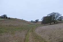
Croker's Hole is a 4.4 hectare biological Site of Special Scientific Interest near Upper Lambourn in Berkshire. The local planning authorities are Newbury District Council and Berkshire County Council.[1][2]
The site is a narrow grassland valley, which is one of the most florally diverse chalk downlands in Berkshire. The dominant plants are upright brome and tor-grass, and it is the only site in the county which has the nationally rare bastard-toadflax (Thesium humifusum).[1]
There is access from a footpath from Seven Barrows to Hangman's Stone.
See also
 |
Wikimedia Commons has media related to Croker's Hole. |
References
- 1 2 "Croker's Hole citation" (PDF). Sites of Special Scientific Interest. Natural England. Retrieved 28 December 2014.
- ↑ "Map of Croker's Hole". Sites of Special Scientific Interest. Natural England. Retrieved 28 December 2014.
Coordinates: 51°32′10″N 1°32′03″W / 51.5360°N 1.5343°W
This article is issued from Wikipedia - version of the 3/31/2016. The text is available under the Creative Commons Attribution/Share Alike but additional terms may apply for the media files.