Cultural Center Station
Cultural Center 文化中心 | |
|---|---|
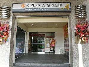 Cultural Center Station Exit 4 | |
| Location |
Sinsing and Lingya, Kaohsiung Taiwan |
| Operated by | |
| Line(s) |
|
| Platforms | 1 island platform |
| Connections | Bus stop |
| Construction | |
| Structure type | Underground |
| History | |
| Opened | September 14, 2008 |
| Traffic | |
| Passengers | 5,952 daily (Jan. 2011)[1] |
| Cultural Center Station | |||||||||||||
| Traditional Chinese | 文化中心車站 | ||||||||||||
|---|---|---|---|---|---|---|---|---|---|---|---|---|---|
| Simplified Chinese | 文化中心车站 | ||||||||||||
| |||||||||||||
The Kaohsiung MRT Cultural Center Station is an underground station on the Orange Line in the edge of Sinsing District and Lingya District, Kaohsiung, Taiwan.
Station overview
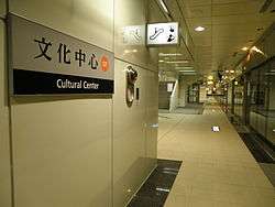
Cultural Center Station platform.
The station is a two-level, underground station with an island platform and four exits.[2] The station is 199 meters long and is located at the intersection Jhongjheng 2nd Rd. and Heping 1st Rd.[3]
Station layout
| Street Level | Entrance/Exit | Entrance/Exit |
| B1 | Concourse | Lobby, information desk, automatic ticket machines, one-way faregates, Restrooms (Near Exits 3) |
| B2 | Platform 1 | ← KMRT Orange Line toward Sizihwan (Sinyi Elementary School) |
| Platform 2 | → KMRT Orange Line toward Daliao (Wukuaicuo) → | |
Exits
- Exit 1: Jhongjheng 2nd Rd. (west)
- Exit 2: Shangyi St., Wufu Junior High School
- Exit 3: Kaohsiung Cultural Center, National Kaohsiung Normal University
- Exit 4: President Department Store Heping branch, Rainbow Park
Around the station
- Kaohsiung Cultural Center
- National Kaohsiung Normal University
- President Department Store
- Water Tower Park
- Wufu Junior High School
Nearby stations
| Preceding station | Kaohsiung MRT | Following station | ||
|---|---|---|---|---|
toward Sizihwan | Orange Line | toward Daliao |
References
| Wikimedia Commons has media related to Cultural Center Station. |
- ↑ "統計資訊 > 統計月報". Transportation Bureau, Kaohsiung City Government. Retrieved 2011-02-15.
- ↑ "文化中心站". 高雄捷運公司. Retrieved 2010-07-05.
- ↑ "文化中心站週邊地圖". 高雄捷運公司. Retrieved 2010-07-05.
Coordinates: 22°37′49″N 120°19′03″E / 22.63028°N 120.31750°E
This article is issued from Wikipedia - version of the 10/19/2016. The text is available under the Creative Commons Attribution/Share Alike but additional terms may apply for the media files.