1994–95 Australian region cyclone season
1994–95 Australian region cyclone season
| |
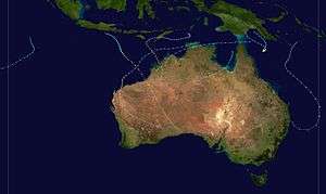
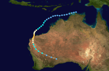
| Season summary map |
| First system formed |
12 December 1994 |
| Last system dissipated |
23 April 1995 |
| Strongest storm1 |
Chloe – 920 hPa (mbar), 200 km/h (125 mph) (10-minute sustained) |
| Tropical lows |
19 |
| Tropical cyclones |
6 |
| Tropical cyclones |
6 |
| Severe tropical cyclones |
9 |
| Total fatalities |
1 |
| Total damage |
Unknown |
| 1Strongest storm is determined by lowest pressure |
Australian region tropical cyclone seasons
1992–93, 1993–94, 1994–95, 1995–96, 1996–97 |
| Related articles |
|
|
The 1994–95 Australian region cyclone season was a moderately active Australian cyclone season. It was also an event in the ongoing cycle of tropical cyclone formation. It ran from 1 November 1994 to 30 April 1995. The regional tropical cyclone operational plan also defines a tropical cyclone year separately from a tropical cyclone season, and the "tropical cyclone year" ran from 1 July 1994 to 30 June 1995.
Tropical cyclones in this area were monitored by four Tropical Cyclone Warning Centres (TCWCs): the Australian Bureau of Meteorology in Perth, Darwin, and Brisbane; and TCWC Port Moresby in Papua New Guinea.
Storms
Severe Tropical Cyclone Annette
| Category 4 severe tropical cyclone (Australian scale) |
| Category 3 tropical cyclone (SSHWS) |
|
|
| Duration |
12 December – 20 December |
| Peak intensity |
195 km/h (120 mph) (10-min) 925 hPa (mbar) |
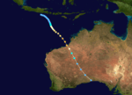
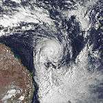
Annette formed on 12 December 1994. The storm moved southeastward while intensifying to a Category 4 cyclone. Annette made landfall at Mandora Station on 18 December. There was considerable damage to homes and crops and about 1,000 cattle were lost in the storm.[1]
Tropical Low Heida
| Tropical low (Australian scale) |
| Tropical depression (SSHWS) |
|
|
| Duration |
3 February – 4 February(Exited basin) |
| Peak intensity |
55 km/h (35 mph) (10-min) 995 hPa (mbar) |
Tropical Low Heida developed on 3 February and existed the basin on the next day.
Severe Tropical Cyclone Bobby
| Category 4 severe tropical cyclone (Australian scale) |
| Category 3 tropical cyclone (SSHWS) |
|
|
| Duration |
19 February – 27 February |
| Peak intensity |
195 km/h (120 mph) (10-min) 925 hPa (mbar) |
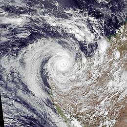
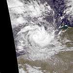
Severe Tropical Cyclone Bobby, a Category 4 cyclone with estimated winds up to 270 km/hour near the centre, crossed the Western Australian Pilbara coast to the east of Onslow between midnight and 0100 on the 25 February 1995. Seven lives were lost when two fishing trawlers were sunk off the coast from Onslow. A bulk ore carrier also ran aground in the cyclone. There was very minor property damage reported from the Karratha area and approximately 20 houses in Onslow suffered superficial roofing damage. Cyclone Bobby also brought heavy rains and extensive flooding to the south of the Pilbara area, which damaged roads, bridges and crops and seriously affected mining production. A motorist was drowned inland from Carnarvon while attempting to cross a flooded creek.[2][3][4]
Severe Tropical Cyclone Violet
| Category 3 severe tropical cyclone (Australian scale) |
| Category 1 tropical cyclone (SSHWS) |
|
|
| Duration |
2 March – 8 March |
| Peak intensity |
150 km/h (90 mph) (10-min) 960 hPa (mbar) |
Violet lasted ten days.[5]
Severe Tropical Cyclone Warren
| Category 3 severe tropical cyclone (Australian scale) |
| Tropical storm (SSHWS) |
|
|
| Duration |
4 March – 7 March |
| Peak intensity |
140 km/h (85 mph) (10-min) 960 hPa (mbar) |
Warren last four days.[5]
Severe Tropical Cyclone Chloe
| Category 4 severe tropical cyclone (Australian scale) |
| Category 4 tropical cyclone (SSHWS) |
|
|
| Duration |
3 April – 9 April |
| Peak intensity |
200 km/h (125 mph) (10-min) 920 hPa (mbar) |
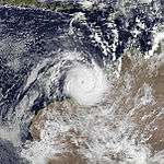
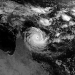
The third major cyclone to strike Australia. Cyclone Chloe reached Category 4 status before making landfall in the uninhabited section of the coast of the Kimberley region of Western Australia on 7 April 1995. The storm dissipated well inland.[1]
Tropical Depression 20P
| Tropical depression (SSHWS) |
|
|
| Duration |
3 April – 4 April |
| Peak intensity |
45 km/h (30 mph) (1-min) 1004 hPa (mbar) |
Tropical Depression 20P existed from 3 April to 4 April.
Severe Tropical Cyclone Agnes
| Category 4 severe tropical cyclone (Australian scale) |
| Category 3 tropical cyclone (SSHWS) |
|
|
| Duration |
16 April – 23 April |
| Peak intensity |
165 km/h (100 mph) (10-min) 945 hPa (mbar) |
Anges formed on April 15, only to dissipate over a week later.[5]
See also
References
