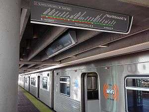
Dadeland South station
| Metrorail metro station | |||||||||||||||
 Dadeland South platform | |||||||||||||||
| Location |
9150 Dadeland Boulevard Kendall, Florida 33156 | ||||||||||||||
| Coordinates | 25°41′6″N 80°18′49″W / 25.68500°N 80.31361°WCoordinates: 25°41′6″N 80°18′49″W / 25.68500°N 80.31361°W | ||||||||||||||
| Owned by | Miami-Dade County | ||||||||||||||
| Line(s) | |||||||||||||||
| Platforms | 1 island platform | ||||||||||||||
| Tracks | 2 | ||||||||||||||
| Connections |
| ||||||||||||||
| Construction | |||||||||||||||
| Parking | Garage (1060 spaces), surface lot (200 spaces) | ||||||||||||||
| Bicycle facilities | Rack | ||||||||||||||
| Disabled access | Yes | ||||||||||||||
| Other information | |||||||||||||||
| Station code | DLS | ||||||||||||||
| History | |||||||||||||||
| Opened | May 20, 1984 | ||||||||||||||
| Traffic | |||||||||||||||
| Passengers (2012) |
2.2 million[1] | ||||||||||||||
| Services | |||||||||||||||
| |||||||||||||||
| Location | |||||||||||||||
 | |||||||||||||||
Dadeland South station is a transfer station of the Metrorail rapid transit system in the Dadeland district of Kendall, Florida, a CDP and unincorporated community located in Miami-Dade County. It is the southern terminus of the system. This station is located near the intersection of Dadeland Boulevard and Datran Boulevard, adjacent to South Dixie Highway (US 1), three blocks southwest of Kendall Drive and Dadeland Mall, and just east of the US 1–Palmetto Expressway (SR 826) junction. It opened to service May 20, 1984.
Places of interest
- Downtown Dadeland
- Dadeland Mall
- Dadeland Marriott
- Datran Towers Complex
- Metropolis at Dadeland
- Town Center One
- South Miami-Dade Busway
- The Falls (via Busway to SW 136 St)
Transit connections
Metrobus
| Route # | Route Name | Route Map | Note |
|---|---|---|---|
| 31 | Busway Local (Southland Mall Park & Ride via Busway to SW 112 Ave) | Map | |
| 34 | Busway Flyer (Florida City via Busway, US 1, and Krome Avenue) | Map | Weekday rush hour service only |
| 38 | Busway MAX (Florida City via Busway and US 1) | Map | |
| 52 | Dadeland North station ↔ South Miami-Dade Health Center via Busway | Map | |
| 73 | Miami Gardens Drive at NW 68 Avenue via Ludlam Road (West 67 Ave) and Milam Dairy Road (West 72 Ave) | Map | |
| 88 | SW 157 Ave via Kendall Drive (South 88 St) | Map | |
| 136 | SW 112 St & 137 Ave via Busway and southern Miami-Dade County or Douglas Road station via Old Cutler Road | Map | Weekday service only |
| 252 | Coral Reef MAX (Country Walk or SW 162 Ave [252A] via Coral Reef Drive) | Map | |
| 287 | Saga Bay MAX (South Dade via Busway, Galloway Road and South 216 St) | Map | Weekday rush hour only |
| 500 | Midnight Owl (Government Center Downtown Bus Terminal via Metrorail) | Map | Overnight service only |
References
External links
 Media related to Dadeland South metro station at Wikimedia Commons
- MDT – Metrorail Stations
- Station from Dadeland Boulevard from Google Map Street View
This article is issued from Wikipedia - version of the 11/8/2016. The text is available under the Creative Commons Attribution/Share Alike but additional terms may apply for the media files.
