Dalseong County
| Dalseong 달성군 | |
|---|---|
| County | |
| Korean transcription(s) | |
| • Hanja | 達城郡 |
| • Revised Romanization | Dalseong-gun |
| • McCune-Reischauer | Talsŏng kun |
 | |
|
| |
| Country | South Korea |
| Region | Yeongnam |
| Provincial level | Daegu |
| Area | |
| • Total | 427.03 km2 (164.88 sq mi) |
| Population | |
| • Total | 160,363 |
| • Density | 380/km2 (970/sq mi) |
| • Dialect | Gyeongsang |
| Website | Dalseong County Office |
Dalseong County (Dalseong-gun) is a gun occupying much of south and western Daegu, South Korea. A largely rural district lying along the Nakdong River, it makes up nearly half of Daegu's total area. It is divided in half by a narrow piece of Dalseo-gu that reaches west to the river.
Like the other local government units in South Korea, Dalseong-gun enjoys a moderate degree of local autonomy. The county magistrate and council are elected by the local citizens, although their authority is sharply curtailed. The seat of government is located in Nongong-eup. The current magistrate is Lee Jong-jin.
Dalseong-gun enters historical records in 757, as Daegu-hyeon, a subsidiary of Suchang-gun (modern-day Suseong-gu). Dalseong-gun became part of Daegu Metropolitan City in 1995, as part of a general reform of local governments.
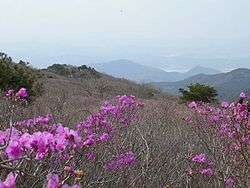
As the near hinterland of Daegu, Dalseong-gun is known as a center of truck farming and tourism. Landmarks of Dalseong-gun include Biseulsan and the Naengcheon resort area beneath Paljoryeong.
The name Dalseong means "Dal Castle," and comes from the earlier name of Daegu, Dalgubeol.
Administrative divisions

Dalseong-gun is divided into three eup and six myeon. These are in turn divided into 279 ri and 1470 ban.
- Dasa-eup
- Hwawon-eup
- Nongong-eup
- Gachang-myeon
- Guji-myeon
- Habin-myeon
- Hyeonpung-myeon
- Okpo-myeon
- Yuga-myeon
See also
External links
Coordinates: 35°46′N 128°26′E / 35.767°N 128.433°E