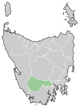
Derwent Valley Council
| Derwent Valley Council Tasmania | |||||||||||||
|---|---|---|---|---|---|---|---|---|---|---|---|---|---|
 Derwent Valley Council | |||||||||||||
| Coordinates | 42°45′36″S 146°37′48″E / 42.76000°S 146.63000°ECoordinates: 42°45′36″S 146°37′48″E / 42.76000°S 146.63000°E | ||||||||||||
| Population | 10,118 (2010 est)[1] | ||||||||||||
| • Density | 2.4612/km2 (6.3745/sq mi) | ||||||||||||
| Area | 4,111 km2 (1,587.3 sq mi) | ||||||||||||
| Mayor | Martyn Evans | ||||||||||||
| Council seat | New Norfolk | ||||||||||||
| Region | Upper Derwent River region | ||||||||||||
| State electorate(s) | Lyons | ||||||||||||
| Federal Division(s) | Lyons | ||||||||||||
|
| |||||||||||||
| Website | Derwent Valley Council | ||||||||||||
| |||||||||||||
The Derwent Valley Council is a local government area of Tasmania, Australia. It covers the upper part of the Derwent River, from the major town of New Norfolk (just north-west of Hobart) to the remote south-west Hydro town of Strathgordon.
The Tarn Shelf is located within this region and is an area of significant botanic interest. One unique plant that is only found in this area is a cross between the King Billy and Huon Pine.
The council logo depicts an oast house (a kiln for drying hops), trees and a roll of paper which are representative of major industries in the municipality.
Some tourism materials combine the LGA area with that of the Central Highlands to call it Derwent Valley and highlands region.[2]
References
- ↑ Australian Bureau of Statistics (31 March 2011). "3218.0 - Regional Population Growth, Australia, 2009-10". Retrieved 23 August 2011. Estimated resident population (ERP) at 30 June 2010.
- ↑ http://www.about-australia.com/tasmania/derwent-valley-highlands/
External links
This article is issued from Wikipedia - version of the 10/27/2016. The text is available under the Creative Commons Attribution/Share Alike but additional terms may apply for the media files.