Don Marcelino, Davao Occidental
| Don Marcelino | |
|---|---|
| Municipality | |
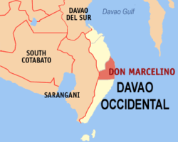
 Map of Davao Occidental with Don Marcelino highlighted | |
.svg.png) Don Marcelino Location in the Philippines | |
| Coordinates: 06°16′N 125°40′E / 6.267°N 125.667°ECoordinates: 06°16′N 125°40′E / 6.267°N 125.667°E | |
| Country | Philippines |
| Region | Davao (Region XI) |
| Province | Davao Occidental |
| District | Lone District of Davao Occidental |
| Barangays | 15 |
| Government[1] | |
| • Mayor | John Harvey Johnson |
| Area[2] | |
| • Total | 407.30 km2 (157.26 sq mi) |
| Population (2010)[3] | |
| • Total | 41,942 |
| • Density | 100/km2 (270/sq mi) |
| Time zone | PST (UTC+8) |
| ZIP code | 8013 |
| Dialing code | 82 |
| Income class | 3rd |
Don Marcelino is a third class municipality in the province of Davao Occidental, Philippines. According to the 2010 census, it has a population of 41,942 people.[3]
Barangays
Don Marcelino is politically subdivided into 15 barangays.[2]
- Baluntaya
- Calian
- Dalupan
- Kinanga (Poblacion)
- Kiobog
- Lanao
- Lapuan
- Lawa
- Linadasan
- Mabuhay
- North Lamidan
- Nueva Villa
- South Lamidan
- Talaguton
- West Lamidan
Demographics
| Population census of Don Marcelino | ||
|---|---|---|
| Year | Pop. | ±% p.a. |
| 1990 | 27,100 | — |
| 1995 | 29,968 | +1.90% |
| 2000 | 33,403 | +2.35% |
| 2007 | 35,166 | +0.71% |
| 2010 | 41,942 | +6.62% |
| Source: National Statistics Office[3] | ||
Local government
Municipal officials 2016-2019:[1]
- Mayor: Michael A. Maruya
- Vice-Mayor: John H. Johnson
- Councilors:
- Leopoldo M. Cadulang
- Annie Blangket Sumalinog
- Danilo I. Omicas
- Jaime P. Bansil
- Renato S. Bautista
- Elizabeth M. Maruya
- Jorge D. Gildore
- Neil P. Johnson
- Reynold G. Llanto
References
- 1 2 "Official City/Municipal 2013 Election Results". Intramuros, Manila, Philippines: Commission on Elections (COMELEC). 1 July 2013. Retrieved 5 September 2013.
- 1 2 "Province: Davao Occidental". PSGC Interactive. Makati City, Philippines: National Statistical Coordination Board. Retrieved 12 May 2014.
- 1 2 3 "Total Population by Province, City, Municipality and Barangay: as of May 1, 2010" (PDF). 2010 Census of Population and Housing. National Statistics Office. Retrieved 12 May 2014.
External links
- Philippine Standard Geographic Code
- Philippine Census Information
- Local Governance Performance Management System
 |
Alabel, Sarangani | Malita | Davao Gulf |  |
| Malapatan, Sarangani | |
Philippine Sea | ||
| ||||
| | ||||
| Jose Abad Santos |
This article is issued from Wikipedia - version of the 8/10/2016. The text is available under the Creative Commons Attribution/Share Alike but additional terms may apply for the media files.