Faubourg Saint-Germain
The Faubourg Saint Germain (French pronunciation: [fobuʁ sɛ̃ ʒɛʁmɛ̃]) is a historic district of Paris. The faubourg has long been known as the favorite home of the French high nobility and hosts many aristocratic Hôtels particuliers. It is currently part of the 7th arrondissement.
History
In its early history, Faubourg Saint-Germain was an agricultural suburb of Paris, lying west of the historical Saint-Germain-des-Prés urban district.
In 1670, Louis XIV initiated a project of grandiose home and hospital for aged and unwell soldiers: the Invalides. The king chose a site at the western end of the Faubourg and commissioned architect Libéral Bruant. The enlarged project was completed in 1676, the river front measured 196 metres and the complex had fifteen courtyards, the largest being the cour d'honneur ("court of honour") for military parades. Jules Hardouin Mansart assisted the aged Bruant, and the chapel was finished in 1679 to Bruant's designs after the elder architect's death. The construction of the Invalides opened a new district to urbanizing, offering large empty spaces between the new monument and the old city limit: the Faubourg's history had started.

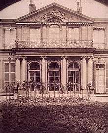
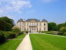
During the 18th century, French high nobility started to move from the central Marais, the then-aristocratic district of Paris where nobles used to build their urban mansions[1] (see Hotel de Soubise) to the clearer, less populated and less polluted Faubourg Saint-Germain that soon became the new residence of French highest nobility. The district became so fashionable within the French aristocracy that the phrase le Faubourg has been used to describe French nobility ever since.[2] The oldest and most prestigious families of the French nobility built outstanding residences in the area such as the Hôtel Matignon, the Hôtel de Salm or the Hôtel Biron.
After the Revolution many of these mansions, offering magnificent inner spaces, many receptions rooms and exquisite decoration, were confiscated and turned into national institutions. The French expression "les ors de la Republique" (literally "the golds of the Republic"), referring to the luxurious environment of the national palaces (outstanding official residences and priceless works of art) comes from that time.
During the Restoration of the Bourbon dynasty, the Faubourg recovered its past glory as the most exclusive high nobility district of Paris. Moreover, home to the Ultra Party, it was the political center of the country. The Ultra pushed towards counter-revolutionary laws, reinforcing Catholic Church's power (Anti-Sacrilege Act) and voting the infamous Loi du Milliard aux émigrés[3] (literally the Emigrates' Billion Act) which was made to compensate French nobility for its Revolutionary era's loss in terms of fortune and land.
But after the Fall of Charles X during the July Revolution, the district lost most of its political influence. During the July Monarchy, from 1830 to 1848, when the junior Orleanist branch held the throne, the Faubourg was politically marginalized, many noble family withdrawing from active participation in political life to their castles, urban mansions in the Faubourg and passive but brilliant social life. Therefore, the Faubourg remained the center of French upper class' social life. Nowadays, the Faubourg-as the rest of the 7th arrondissement- is still is one of the most exclusive districts of Paris (see Paris Ouest).
Geography
The Faubourg Saint-Germain is the eastern part of the current 7th arrondissement, roughly the area between the Invalides and the 6th arrondissement's border. The neighborhood is bounded by the Seine River on the north, the Esplanade des Invalides/Boulevard des Invalides on the west, rue de Babylone on the south, and Bd Raspail and Bd Saint-Germain on the east.
See also
References
- ↑ Hotels particuliers in French
- ↑ Honoré de Balzac explains the very specific Faubourg's aristocratic way of life in his novel La Duchesse de Langeais
- ↑ Honoré de Balzac wrote the short story Madame Firmiani about the law and its consequences
Coordinates: 48°51′29″N 2°19′12″E / 48.8580°N 2.3200°E

.jpg)
