Fluntern

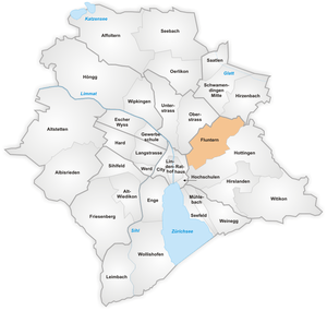
The quarter of Fluntern in Zurich.

The Zurich Zoo entrance

Zürichberg seen from Fluntern church
Fluntern is a quarter in the district 7 in Zurich.
It was formerly a municipality of its own, having been incorporated into Zurich in 1893.
Built in 1901 as Rigiblick restaurant, the former Gastsaal was re-opened as Theater Rigiblick in 1984.[1]
The quarter has a population of 7,325 distributed on an area of 2.84 km².
Climate
| Climate data for Zürich / Fluntern (1981-2010) | |||||||||||||
|---|---|---|---|---|---|---|---|---|---|---|---|---|---|
| Month | Jan | Feb | Mar | Apr | May | Jun | Jul | Aug | Sep | Oct | Nov | Dec | Year |
| Average high °C (°F) | 2.9 (37.2) |
4.6 (40.3) |
9.5 (49.1) |
13.8 (56.8) |
18.5 (65.3) |
21.6 (70.9) |
24.0 (75.2) |
23.3 (73.9) |
18.8 (65.8) |
13.7 (56.7) |
7.2 (45) |
3.7 (38.7) |
13.5 (56.3) |
| Daily mean °C (°F) | 0.3 (32.5) |
1.3 (34.3) |
5.3 (41.5) |
8.8 (47.8) |
13.3 (55.9) |
16.4 (61.5) |
18.6 (65.5) |
18.0 (64.4) |
14.1 (57.4) |
9.9 (49.8) |
4.4 (39.9) |
1.4 (34.5) |
9.3 (48.7) |
| Average low °C (°F) | −2.0 (28.4) |
−1.6 (29.1) |
1.7 (35.1) |
4.5 (40.1) |
8.8 (47.8) |
11.9 (53.4) |
14.0 (57.2) |
13.8 (56.8) |
10.5 (50.9) |
7.0 (44.6) |
2.0 (35.6) |
−0.7 (30.7) |
5.8 (42.4) |
| Average precipitation mm (inches) | 63 (2.48) |
64 (2.52) |
79 (3.11) |
83 (3.27) |
123 (4.84) |
128 (5.04) |
124 (4.88) |
124 (4.88) |
99 (3.9) |
86 (3.39) |
79 (3.11) |
83 (3.27) |
1,134 (44.65) |
| Average snowfall cm (inches) | 18.4 (7.24) |
22 (8.7) |
13.7 (5.39) |
3 (1.2) |
0 (0) |
0 (0) |
0 (0) |
0 (0) |
0 (0) |
0.8 (0.31) |
8 (3.1) |
19.1 (7.52) |
85 (33.5) |
| Average precipitation days (≥ 1.0 mm) | 10.5 | 9.3 | 11.9 | 11.4 | 12.4 | 12.7 | 12.3 | 11.6 | 10.2 | 9.9 | 10.3 | 11.4 | 133.9 |
| Average snowy days (≥ 1.0 cm) | 4.8 | 5.2 | 3.2 | 0.7 | 0 | 0 | 0 | 0 | 0 | 0.1 | 1.6 | 4.8 | 20.4 |
| Average relative humidity (%) | 84.2 | 79.4 | 73.9 | 71.2 | 71.8 | 72.4 | 71.3 | 75.8 | 78.9 | 83.7 | 83.8 | 84.6 | 77.6 |
| Mean monthly sunshine hours | 55 | 81 | 124 | 153 | 175 | 189 | 215 | 200 | 150 | 102 | 59 | 42 | 1,544 |
| Source: MeteoSwiss [2] | |||||||||||||
References
- ↑ Theater Rigiblick in: Tobias Hoffmann-Allenspach (2013-12-05). "Theatersaal Rigiblick, Zürich ZH" (in German). theaterwissenschaft.ch. Retrieved 2015-10-30.
- ↑ "Climate Norm Value Tables". Climate diagrams and normals from Swiss measuring stations. Federal Office of Meteorology and Climatology (MeteoSwiss). Retrieved 23 January 2013. The weather station elevation is 555 meters above sea level.
| Wikimedia Commons has media related to Fluntern. |
Coordinates: 47°22′34″N 8°33′36″E / 47.376°N 8.560°E
This article is issued from Wikipedia - version of the 5/15/2016. The text is available under the Creative Commons Attribution/Share Alike but additional terms may apply for the media files.