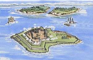
Fort Lévis
| Fort Lévis | |
|---|---|
| Ogdensburg, New York | |
|
Map of Fort Lévis | |
| Type | Fort |
| Site information | |
| Controlled by | New France |
| Site history | |
| Built | 1759 |
| In use | 1759-1760 |
| Battles/wars | |
|
Fort Lévis | |
 | |
| Location | Isle Royale, near Ogdensburg, New York |
| Coordinates | 44°44′27.1″N 75°26′30.0″W / 44.740861°N 75.441667°WCoordinates: 44°44′27.1″N 75°26′30.0″W / 44.740861°N 75.441667°W |
| Area | 23.75 acres (9.61 ha) |
| NRHP Reference # | 10000944 |
| Added to NRHP | November 26, 2010 |
Fort Lévis, a fortification on the St. Lawrence River, was built in 1759 by the French. They had decided that Fort de La Présentation was insufficient to defend the St. Lawrence against the British. Named for François Gaston de Lévis, Duc de Lévis, the fort was constructed on Isle Royale, three miles downstream from the other fort. Although some military officials wanted a masonry fort, it was built of wood, in a four bastioned, square configuration.
It was short-lived as a French fort, being captured by Major-General Amherst in August 1760 in the Battle of the Thousand Islands. Captain Patrick Sinclair was left to secure the area while Amherst proceeded on his way to attack Montreal.
The fort was rebuilt by the British as Fort William Augustus. The island, Chimney Island (or Isle Royale), on which the fort stood was partially destroyed during the construction of the St. Lawrence Seaway in the 1950s. The submerged location is near Ogdensburg, New York
External links
References
| Wikimedia Commons has media related to Fort Lévis. |
