Furzton
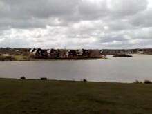
Coordinates: 52°00′18″N 0°45′50″W / 52.005°N 0.764°W Furzton is a district in West Milton Keynes in the civil parish of Shenley Brook End, Buckinghamshire, England.[1][2] The man-made Furzton Lake is a balancing lake that covers approximately half of the district.
History

The housing in South Furzton was built sometime around the early to mid-1980s, with the Parkside/Favell Drive housing to the East coming first – development then moved West along Blackmoor Gate. The shops were constructed after 1984 – prior to this time, the nearest local shops were at Melrose Avenue, in Bletchley.
Prior to the construction of North Furzton, the land on the northern side of the brook in the linear park was farmland – thus, residents of South Furzton had only a short walk to reach open countryside. When plans were announced for North Furzton, in particular the extension of Dulverton Drive to form the link between the two sides, residents' meetings were held in protest at what residents expected would be a significant increase in traffic. Most of the South Furzton housing was complete when the construction of the lake started.
North Furzton housing and shops were built between 1990 and 2004.
References
- ↑ Ordnance Survey: Landranger map sheet 152 Northampton & Milton Keynes (Buckingham & Daventry) (Map). Ordnance Survey. 2014. ISBN 9780319231715.
- ↑ "Ordnance Survey: 1:50,000 Scale Gazetteer" (csv (download)). www.ordnancesurvey.co.uk. Ordnance Survey. 1 January 2016. Retrieved 18 February 2016.