Garrold's Meadow
| Site of Special Scientific Interest | |
 | |
| Area of Search | Essex |
|---|---|
| Grid reference | TQ 823888 |
| Interest | Biological |
| Area | 5.0 hectares |
| Notification | 1988 |
| Location map | Magic Map |
Garrold's Meadow is a 5 hectare biological Site of Special Scientific Interest north of Leigh-on-Sea in Essex. The local planning authority is Castle Point Borough Council.[1][2]
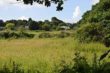
This site is unimproved grassland on gravel in it southern part and clay in the north. There is also an area of marsh. The plant community is diverse, with a number of uncommon species. Grasses include common bent, sweet vernal grass and crested dog's-tail.[1]
There is no public access but the site can be viewed from Eastwood Old Road.
References
- 1 2 "Garrold's Meadow citation" (PDF). Sites of Special Scientific Interest. Natural England. Retrieved 26 June 2016.
- ↑ "Map of Garrold's Meadow". Sites of Special Scientific Interest. Natural England. Retrieved 26 June 2016.
Coordinates: 51°34′05″N 0°37′44″E / 51.568°N 0.629°E
This article is issued from Wikipedia - version of the 8/24/2016. The text is available under the Creative Commons Attribution/Share Alike but additional terms may apply for the media files.