Gavrinis
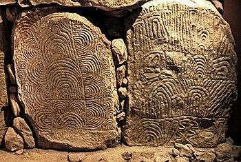
Gavrinis (Breton: Gavriniz) is a small island, situated in the Gulf of Morbihan in Brittany, France. It contains the Gavrinis tomb, a megalithic monument notable for its abundance of megalithic art in the European Neolithic. Administratively, it is part of the commune of Larmor-Baden.
Geography

Reachable by boat from the town of Larmor-Baden, the island of Gavrinis is uninhabited. Located near the opening of Morbihan Gulf to the Atlantic Ocean, the island is basically a granite rock outcrop of 750 x 400m dimensions. Its highest point dominates much of the surrounding area.
Name
The name Gavrinis is popularly believed to be derived from the Breton words gavr (goat) and enez (island), thus suggesting a meaning as "goat island". This is probably a false etymology. In documents dating to 1184 and 1202, the island is named as Guirv Enes and Guerg Enes, respectively. The old Breton word Guerg is not related to gavr, but to parallels like Gaul gwery, or Old Irish ferg, signifying "wrath".
The Gavrinis passage tomb
Importance
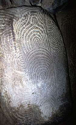
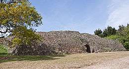
The island is famous because of its important passage grave, a megalithic monument from the Neolithic period, belonging to the same broad context as the Breton megaliths of Carnac and Locmariaquer, and closely connected with the monuments at Brú na Boínne (Ireland) and Maes Howe (Orkney). At the time of its construction, c. 3500 BC, the island was still connected with the mainland. The rich internal decorations make Gavrinis one of the major treasuries of European megalithic art. The tomb is also remarkable for the care taken in its construction and its good preservation.
History of research
The first excavations took place in 1835, when the internal chamber was discovered. Further research was undertaken by the archaeologist Zacharie Le Rouzic who began restoration work around 1930. Further works took place in the 1960s and 1970s. Charles-Tanguy Leroux, former Director of Breton Antiquities, undertook studies and consolidation works in the 1980s. Further excavation is in the planning stages.[1]
Date
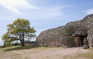
The tomb was built relatively late within the French megalithic sequence. Its use ceased around 3000 BC. At that time, the light wooden structures cladding its entrance were burnt, after which part of the mound collapsed, obscuring and blocking the passage. A layer of windblown sand transformed the monument into a simple hillock.
The cairn
The stone mound has a diameter of about 50m. The mass of stones forming the cairn is internally structured by a series of walls, subdividing it into separate "ranks". It is a characteristic example of Neolithic dry stone architecture.
The chamber
The mound covers a single rectangular (nearly square) slab-built burial chamber, located at the centre of the mound and measuring about 2.5m across. The chamber is built of about 50 carefully placed slabs. The biggest of these is the ceiling slab which weighs nearly 17 tons. Such simple dolmen-type chambers, reached by passages, were very common in Brittany between 4500 and 3000 BC. At the same time, similar monuments were constructed in Normandy and Poitou, in Ireland, Britain and the Iberian Peninsula.
The passage and its art
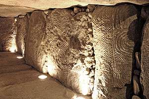
The chamber is reached from outside by a 14m long corridor or passage. Of the 29 orthostat slabs that form the sides of the passage, 23 are decorated with carved symbols and patterns. Some of the symbols appear to represent non-abstract objects, like axes and croziers or staffs. A common horn-like motif may symbolise cattle, a shape conventionally called the shield may be a very stylised human figure. More abstract motifs include zigzag lines, lozenges and snake-like lines.
Reuse of stones
In 1984, it was discovered that the external side of some slabs, now covered by cairn material, is also decorated, but in a different style from their internal face. This decoration must have been applied before the cairn was erected. Archaeologists suspect that at least a number of those slabs may be in secondary use, having formed part of earlier monuments elsewhere. Most strikingly, the top of the chamber's ceiling slab bore the depiction of a bull, the horns of a further animal and a motif known from other monuments that has often been interpreted as an axe (Twohig 1981) but which has also been interpreted as a representation of a whale, and thus as a "mythic animal" (Whittle 2000). The slab can be joined with the ceiling stones of two other monuments, the Table des Marchands dolmen and the Er Vinglé tomb, at Locmariaquer, at a distance of 4 km. The three slabs appear to have once formed a massive 14m standing stone, similar to the great broken menhir of Locmariaquer, which broke or was broken, to be reused as three ceiling slabs, its decorations deliberately obscured.
Replica
A replica of part of the Gavrinis passage with its decorated slabs can be visited in the Museum at the megalithic necropolis of Bougon, (Deux-Sèvres).
Bibliography
- Charles-Tanguy Leroux, Gavrinis et les mégalithes du golfe du Morbihan, Éditions Jean-Paul Gisserot, 2006.
- J. L'Helgouac'H, "Les Idoles qu'on abat", Bulletin de la Société Polymatique du Morbihan 110, 1983, pp 57–68.
- Charles-Tanguy Le Roux, "New excavations at Gavrinis", Antiquity 59, 1985, pp 183–187.
- Charles-Tanguy Le Roux, "Gavrinis et les îles du Morbihan", Guides archéologiques de la France, Paris, Ministère de la Culture, 1985.
- Charles-Tanguy Le Roux, Gavrinis, J.P. Gisserot, Paris 1995.
- CASSEN, S. et J. L'Helgouac'H, 1992. Du Symbole de la crosse: chronologie, répartition et interprétation. XVIIème colloque interrégional sur le Néolithique: Vannes 1990, actes. Rennes: RAO, supplément 5:223-235.
- Twohig, E.S., 1981. The Megalithic Art of Western Europe, Oxford: Clarendon
- Whittle, Alisdair, "Very Like a Whale: Menhirs,Motifs and Myths in the Mesolithic-Neolithic Transition of Northwest Europe", Cambridge Archaeological Journal, 10, 2000, pp 243–259.
See also
- Table des Marchand (Locmariaquer)
- Newgrange
- Maes Howe
- Barnenez
- Bougon
- Knockroe
References
- ↑ Ouest-France, Thursday, 27 July 2006.
External links
- French government guide to the Morbihan megaliths, excellent illustrations
- Gavrinis Images and comparisons to Newgrange in Ireland
| Wikimedia Commons has media related to Gavrinis. |
Coordinates: 47°34′26″N 02°53′52″W / 47.57389°N 2.89778°W