Georgia State Route 193
| ||||
|---|---|---|---|---|
 | ||||
| Route information | ||||
| Maintained by GDOT | ||||
| Length: | 27.2 mi[1] (43.8 km) | |||
| Major junctions | ||||
| South end: |
   US 27 / SR 1 / SR 136 in LaFayette US 27 / SR 1 / SR 136 in LaFayette | |||
   US 27 Bus. / SR 1 Bus. in LaFayette US 27 Bus. / SR 1 Bus. in LaFayette | ||||
| North end: |
 SR 17 southeast of Lookout Mountain SR 17 southeast of Lookout Mountain | |||
| Location | ||||
| Counties: | Walker | |||
| Highway system | ||||
| ||||


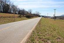
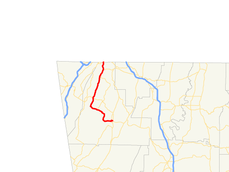
State Route 193 (SR 193) is a 27.2-mile-long (43.8 km) state highway in the northwestern part of the U.S. state of Georgia. It runs southeast-to-north through portions of Walker county.
Route description
SR 193 begins at an intersection with US 27/SR 1 (Lyle Jones Parkway) in LaFayette. This intersection also contains SR 136 (East Villanow Street). The road heads west into the main part of town, where it has a concurrency with US 27 Business/SR 1 Business. The road continues west out of town and gradually curves to the northwest and intersects SR 341 (Cove Road). It then curves to the northeast and has a second intersection with SR 136 (Lookout Mountain Scenic Highway). In Chattanooga Valley, there is a second intersection with SR 341 (Chickamauga Road). Just northeast of Chattanooga Valley is SR 2 (Battlefield Parkway). SR 193 continues to the northeast until it meets its northern terminus, Tennessee State Route 17, at the Tennessee state line, southeast of Lookout Mountain, Tennessee.[1]
Major intersections
The entire route is in Walker County.
| Location | mi[1] | km | Destinations | Notes | |
|---|---|---|---|---|---|
| LaFayette | 0.0 | 0.0 | US 27 / SR 1 / SR 136 – Summerville, Fort Oglethorpe, Resaca | Southern terminus | |
| 0.4 | 0.64 | US 27 Bus. north / SR 1 Bus. north (North Main Street) | Southern end of US 27 Business/SR 1 concurrency | ||
| 0.7 | 1.1 | US 27 Bus. south / SR 1 Bus. south (South Main Street) | Northern end of US 27 Business/SR 1 concurrency | ||
| | 8.8 | 14.2 |  SR 341 north (Cove Road) – Chickamauga SR 341 north (Cove Road) – Chickamauga | Southern terminus of SR 341 | |
| | 14.0 | 22.5 | SR 136 (Lookout Mountain Scenic Highway) – Trenton | ||
| Chattanooga Valley | 22.7 | 36.5 | SR 341 south (Chickamauga Road) – Chickamauga | Northern terminus of SR 341 | |
| | 24.6 | 39.6 |  SR 2 east (Battlefield Parkway) – Fort Oglethorpe SR 2 east (Battlefield Parkway) – Fort Oglethorpe | Western terminus of SR 2 | |
| Tennessee state line | 27.2 | 43.8 | Northern terminus; roadway continues into Tennessee (southeast of Lookout Mountain) as SR 17 north (St. Elmo Avenue) – Chattanooga. | ||
1.000 mi = 1.609 km; 1.000 km = 0.621 mi
| |||||
See also
-
.svg.png) Georgia (U.S. state) portal
Georgia (U.S. state) portal -
 U.S. Roads portal
References
- 1 2 3 Google (June 21, 2013). "Route of SR 193" (Map). Google Maps. Google. Retrieved June 21, 2013.
External links
-
 Media related to Georgia State Route 193 at Wikimedia Commons
 - Georgia Roads (Routes 181 - 200)
- Georgia State Route 193 on State-Ends.com