Grésivaudan
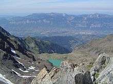
Valley of Grésivaudan
The Grésivaudan (sometimes Graisivaudan) is a valley of the French Alps, situated mostly in the Isère. Etymologically, Graisivaudan comes from roots meaning "Grenoble" (Gratianopolis) and "valley".[1] It comprises the alluvial plain of the Isère River from Grenoble to the confluence of the Arc; or, more recently, the entire valley of the Isère from Tullins to Albertville. The stretch from Tullins to Grenoble is the Bas-Grésivaudan (Lower Grésivaudan) and that between Grenoble and Albertville is the Haut-Grésivaudan (Upper Grésivaudan).
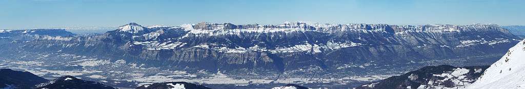
Valley of Grésivaudan seen from the 7 Laux ski resort
References
- ↑ Robert des noms propres (French)
Coordinates: 45°19′00″N 5°57′00″E / 45.3167°N 5.95°E
This article is issued from Wikipedia - version of the 5/1/2016. The text is available under the Creative Commons Attribution/Share Alike but additional terms may apply for the media files.