H'raoua
| H'raoua الهراوة | |
|---|---|
| Municipality | |
| Commune of H'raoua | |
 | |
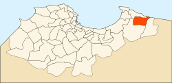 Location of H'raoua within Algiers Province | |
  H'raoua Location of H'raoua within Algeria | |
| Coordinates: 36°46′N 3°19′E / 36.767°N 3.317°ECoordinates: 36°46′N 3°19′E / 36.767°N 3.317°E | |
| Country |
 Algeria Algeria |
| Province | Algiers |
| District | Rouïba |
| Government | |
| • PMA Seats | 11 |
| • PMA president | Mr. Allal Bessaâd (2002-2007) |
| Area | |
| • Total | 13 km2 (5 sq mi) |
| Population (1998) | |
| • Total | 18,167 |
| • Density | 1,400/km2 (3,600/sq mi) |
| Time zone | CET (UTC+01) |
| Postal code | 16900 |
| ONS code | 1641 |
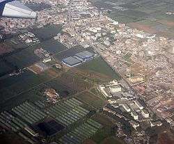
H'raoua is a municipality in Algiers province, Algeria. It is located in Rouïba district, and is an outer suburb of Algiers. It has a small coastline on the Mediterranean Sea. The town proper (chef-lieu agglomeration) of H'raoua is located 2 kilometers (1.2 mi) from the beaches of Terfaya and Kadous. It was created out of parts of Aïn Taya in 1984. Currently, it is the site of the construction of 1853 homes.

This article is issued from Wikipedia - version of the 5/20/2016. The text is available under the Creative Commons Attribution/Share Alike but additional terms may apply for the media files.