Hendra, Cornwall

Hendra, Camelford
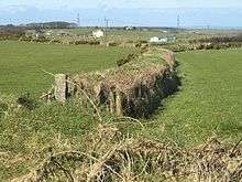
A Cornish hedge at Trehane Farm; the nearer farm is Hendra, in SX1388
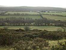
Hendra Downs, Bolventor
Hendra is the name of seven hamlets in Cornwall, England, UK.
- Hendra, Breage (grid reference SW5927,[1] 50°06′07″N 5°22′12″W / 50.102°N 5.370°W)
- Hendra, Camelford (grid reference SX0983,[2] 50°37′16″N 4°41′56″W / 50.6212°N 4.6990°W)
- Hendra, Grade-Ruan (grid reference SW7017,[3] 50°00′48″N 5°12′15″W / 50.0134°N 5.2041°W)
- Hendra, St Dennis (grid reference SW5927,[4] 50°22′54″N 4°53′06″W / 50.3816°N 4.8849°W)
- Hendra, Stithians (grid reference SW7237,[5] 50°11′25″N 5°11′00″W / 50.1904°N 5.1833°W)
- Hendra, Wendron (grid reference SW6931,[6] 50°08′17″N 5°13′56″W / 50.1381°N 5.2321°W)
- Hendra, Withiel (grid reference SW9864,[7] 50°26′33″N 4°50′23″W / 50.4424°N 4.8397°W)
Hendra derives from the Cornish "Hendre", meaning "home farm". There are also places in Ladock, St Ives, St Just, St Teath and Sancreed called Hendra.[8]
The Cornish historian Charles Henderson adopted the bardic name of Map Hendra.
References
External links
![]() Media related to Hendra, Cornwall at Wikimedia Commons
Media related to Hendra, Cornwall at Wikimedia Commons
Cornwall Portal | |
| Unitary authorities | |
| Major settlements |
|
| Rivers | |
| Topics | |
This article is issued from Wikipedia - version of the 6/23/2016. The text is available under the Creative Commons Attribution/Share Alike but additional terms may apply for the media files.