Herefordshire Beacon
| Herefordshire Beacon | |
|---|---|
 Herefordshire Beacon | |
| Highest point | |
| Elevation | 338 m (1,109 ft) [1] |
| Geography | |
| Location | Malvern Hills, England |
| Topo map | OS Landranger 150 |
| Geology | |
| Age of rock | Pre-Cambrian |
| Mountain type | Igneous, Metamorphic |
| Climbing | |
| Easiest route | Hiking |
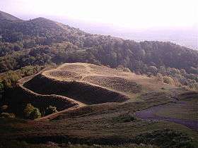
The Herefordshire Beacon is one of the hills of the Malvern Hills. The name Malvern of the nearby town is probably derived from the Welsh moel fryn or "bare hill".
It is 1,109 feet (338 m) high,[1] although the Victorian era inscription at the foot of the hill puts its height at 1,145 feet (349 m). It is surrounded by a British Iron Age hill fort earthwork known as British Camp.
The boundary between Herefordshire and Worcestershire is about 100 metres (330 ft) east of the summit. It is called the Shire Ditch and it is thought to have been built over a law. It was built in two phases and the Citadel on top is known to be medieval, as a castle or a hunting lodge but it was only occupied for a very short amount of time so it is thought to be symbolic. It was thought to be originally built as a ritual site but it also had something to do with the salt industry at the time.
References
| Wikimedia Commons has media related to Herefordshire Beacon. |
- Notes
- 1 2 "Herefordshire Beacon/". Peakery. Retrieved 9 August 2015.
Coordinates: 52°03′30″N 2°21′06″W / 52.0582°N 2.3518°W