Hugihorn
| Hugihorn | |
|---|---|
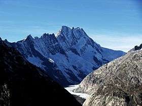
 The Hugihorn (left peak) and the Lauteraarhorn (centre) | |
| Highest point | |
| Elevation | 3,647 m (11,965 ft) |
| Prominence | 82 m (269 ft) [1] |
| Parent peak | Klein Lauteraarhorn |
| Coordinates | 46°34′22″N 8°08′48.5″E / 46.57278°N 8.146806°ECoordinates: 46°34′22″N 8°08′48.5″E / 46.57278°N 8.146806°E |
| Geography | |
 Hugihorn Location in Switzerland | |
| Location | Bern, Switzerland |
| Parent range | Bernese Alps |
| Climbing | |
| Easiest route | rock/snow climb |
The Hugihorn (3,647 m) is a peak of the Bernese Alps, overlooking the Unteraar Glacier in the canton of Bern. It lies south of the Klein Lauteraarhorn, on the range separating the Strahlegg Glacier from the Lauteraar Glacier, both tributaries of the Unteraar Glacier.
The mountain was named after the Swiss geologist Franz Joseph Hugi.
See also
References
External links
This article is issued from Wikipedia - version of the 5/9/2016. The text is available under the Creative Commons Attribution/Share Alike but additional terms may apply for the media files.