Inabanga, Bohol
| Inabanga | |
|---|---|
| Municipality | |
|
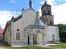
Inabanga main street | |
 Map of Bohol with Inabanga highlighted | |
.svg.png) Inabanga Location within the Philippines | |
| Coordinates: 10°02′N 124°04′E / 10.03°N 124.07°ECoordinates: 10°02′N 124°04′E / 10.03°N 124.07°E | |
| Country | Philippines |
| Region | Central Visayas (Region VII) |
| Province | Bohol |
| District | 2nd district of Bohol |
| Barangay | 50 (see § Barangays) |
| Government [1] | |
| • Type | Sangguniang Bayan |
| • Mayor | Josephine Jumamoy (LP) |
| • Vice mayor | Rodrigo Jumamoy |
| • Town Council |
Members
|
| • Representative | Erico Aristotle Aumentado |
| Area[2] | |
| • Total | 125.63 km2 (48.51 sq mi) |
| Population (2015 census)[3] | |
| • Total | 45,880 |
| • Density | 370/km2 (950/sq mi) |
| • Voter (2016)[4] | 25,979 |
| Time zone | PST (UTC+8) |
| ZIP code | 6332 |
| IDD : area code | +63 (0)38 |
| Income class | 3rd class |
| PSGC | 071224000 |
| Website |
www |
Inabanga is a 3rd municipal income class municipality in the province of Bohol, Philippines.[2] According to the 2015 census, it has a population of 45,880.[3] In the 2016 election, it had 25,979 registered voters.[4]
Geography
Land use:[5]
- Timberland area: 5,305 ha (13,110 acres)
- Mangrove area: 767 ha (1,900 acres)
- Alienable & Disposable (A & D): None
Soil cover:[5]
- Bantog clay
- Inabanga clay
- Bolinao clay
- Annam clay
- Hydrosol
Barangays
Inabanga comprises 50 barangays:
| PSGC | Barangay | Population | ±% p.a. | ||
|---|---|---|---|---|---|
| 2015[3] | 2010[6] | ||||
| 071224001 | Anonang | 1.6% | 748 | 721 | +0.70% |
| 071224002 | Bahan | 1.4% | 651 | 464 | +6.66% |
| 071224003 | Badiang | 2.4% | 1,085 | 1,083 | +0.04% |
| 071224005 | Baguhan | 1.1% | 501 | 541 | −1.45% |
| 071224007 | Banahao | 1.7% | 760 | 652 | +2.96% |
| 071224008 | Baogo | 2.7% | 1,226 | 1,252 | −0.40% |
| 071224009 | Bugang | 1.8% | 810 | 696 | +2.93% |
| 071224010 | Cagawasan | 3.2% | 1,452 | 1,290 | +2.28% |
| 071224011 | Cagayan | 0.9% | 429 | 390 | +1.83% |
| 071224012 | Cambitoon | 2.5% | 1,132 | 919 | +4.05% |
| 071224013 | Canlinte | 0.6% | 276 | 276 | 0.00% |
| 071224014 | Cawayan | 2.1% | 969 | 1,147 | −3.16% |
| 071224015 | Cogon | 1.8% | 820 | 865 | −1.01% |
| 071224016 | Cuaming | 6.4% | 2,951 | 2,826 | +0.83% |
| 071224017 | Dagnawan | 1.4% | 630 | 637 | −0.21% |
| 071224018 | Dagohoy | 3.4% | 1,540 | 1,310 | +3.13% |
| 071224019 | Dait Sur | 1.7% | 778 | 622 | +4.35% |
| 071224020 | Datag | 1.4% | 661 | 559 | +3.24% |
| 071224021 | Fatima | 1.9% | 861 | 721 | +3.44% |
| 071224022 | Hambongan | 1.5% | 666 | 523 | +4.71% |
| 071224023 | Ilaud (Pob.) | 1.9% | 861 | 954 | −1.93% |
| 071224024 | Ilaya | 0.9% | 414 | 376 | +1.85% |
| 071224025 | Ilihan | 0.9% | 414 | 398 | +0.75% |
| 071224027 | Lapacan Norte | 0.9% | 396 | 350 | +2.38% |
| 071224028 | Lapacan Sur | 2.6% | 1,187 | 1,217 | −0.47% |
| 071224029 | Lawis | 2.8% | 1,297 | 1,389 | −1.30% |
| 071224030 | Liloan Norte | 3.3% | 1,492 | 1,490 | +0.03% |
| 071224031 | Liloan Sur | 2.5% | 1,165 | 954 | +3.88% |
| 071224032 | Lomboy | 1.3% | 591 | 589 | +0.06% |
| 071224033 | Lonoy Cainsican | 1.5% | 696 | 656 | +1.13% |
| 071224034 | Lonoy Roma | 1.3% | 581 | 593 | −0.39% |
| 071224035 | Lutao | 2.6% | 1,199 | 1,173 | +0.42% |
| 071224036 | Luyo | 1.8% | 822 | 732 | +2.23% |
| 071224037 | Mabuhay | 1.0% | 449 | 383 | +3.07% |
| 071224038 | Maria Rosario | 1.7% | 764 | 424 | +11.86% |
| 071224039 | Nabuad | 4.4% | 1,998 | 1,804 | +1.96% |
| 071224040 | Napo | 1.6% | 728 | 706 | +0.59% |
| 071224041 | Ondol | 2.4% | 1,107 | 1,122 | −0.26% |
| 071224042 | Poblacion | 2.1% | 966 | 930 | +0.73% |
| 071224043 | Riverside | 0.0% | 0 | 260 | −100.00% |
| 071224044 | Saa | 1.3% | 619 | 634 | −0.45% |
| 071224045 | San Isidro | 1.8% | 844 | 992 | −3.03% |
| 071224046 | San Jose | 4.6% | 2,116 | 1,566 | +5.90% |
| 071224047 | Santo Niño | 1.5% | 686 | 799 | −2.86% |
| 071224048 | Santo Rosario | 2.4% | 1,117 | 997 | +2.19% |
| 071224049 | Sua | 1.5% | 709 | 554 | +4.81% |
| 071224050 | Tambook | 1.0% | 464 | 490 | −1.03% |
| 071224051 | Tungod | 2.6% | 1,184 | 1,089 | +1.61% |
| 071224052 | U‑og | 2.1% | 957 | 1,112 | −2.82% |
| 071224053 | Ubujan | 2.4% | 1,111 | 1,064 | +0.83% |
| Total | 45,880 | 43,291 | +1.11% | ||
Demographics

| Population census of Inabanga | |||||||||||||||||||||||||
|---|---|---|---|---|---|---|---|---|---|---|---|---|---|---|---|---|---|---|---|---|---|---|---|---|---|
|
| ||||||||||||||||||||||||
| Source: Philippine Statistics Office[3][6][7] | |||||||||||||||||||||||||
In the 2016 election, it had 25,979 registered voters, meaning that 57% of the population are aged 18 and over.[4]
Predominant religion: Roman Catholic
Economy
Annual Income (2014):[5] ₱68,144,172
Major industries:[5]
- farming
- fishing
- mat-weaving
- nipa thatch-making
Transportation
Total road length:[5] 130.60 kilometres (81 mi)
Total number of bridges: 8
Utilities
Water supply:[5]
- Main source of potable water: Groundwater
- L1 facilities – 489 water wells
- L2 systems in brgy Pob.
- L3 systems serving 22 barangays
- Potable water demand (1998): 73,230 cubic metres (19,000,000 US gal; 59 acre·ft) per day
Energization status (2010):[5]
- 50 barangays energized
- 8,710 actual household connections (98%)
- 8,900 potential house connections
Number of households with access to sanitary toilets: 7,686 (86%)
Tourist attraction

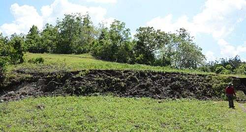
The North Bohol fault, which appeared during the 2013 Bohol earthquake, has become a tourist attraction in Bohol province.[8]
Local government
Welfare[5]
- Number of Barangay Health Stations: 28
- Number of Hospitals: None
- Number of Municipal Health Centers: None
- Number of Day Care Centers: 50
Education
Literacy rate: 92%
-
- North
- Cuaming HS
- Inabanga HS - Nabuad
- Inabanga North Integrated School
- San Jose NHS
- North
-
- South
- Dagnawan Integrated School
- Southern Inabanga HS
- South
-
- North
- Anonang ES
- Baogo ES
- Cambitoon ES
- Cuaming ES
- Dait Sur ES
- Datag ES
- Hambongan ES
- Inabanga North Integrated Sch.
- Lawis ES
- Liloan Norte ES
- Liloan Sur ES
- Nabuad ES
- Ondol ES
- San Isidro ES
- San Jose ES
- North
-
- South
- Banahao ES
- Cagawasan ES
- Cawayan ES
- Dagnawaan Integrated Sch.
- Dagohoy ES
- Inabanga South Central ES
- Lutao ES
- Sto. Rosario ES
- U-og Ubujan ES
- South
References
- ↑ "Municipality". Quezon City, Philippines: Department of the Interior and Local Government. Retrieved 31 May 2013.
- 1 2 "Municipal: Inabanga, Bohol". PSGC Interactive. Quezon City, Philippines: Philippine Statistics Authority. Retrieved 8 January 2016.
- 1 2 3 4 "Region VII (CENTRAL VISAYAS)". Census of Population (2015): Total Population by Province, City, Municipality and Barangay (Report). PSA. Retrieved 20 June 2016.
- 1 2 3 "2016 National and Local Elections Statistics". Commission on Elections. 2016.
- 1 2 3 4 5 6 7 8 "Municipality of Inabanga". www.bohol.gov.ph. Official website of the Province of Bohol. Retrieved 19 December 2014.
- 1 2 "Region VII (CENTRAL VISAYAS)". Census of Population and Housing (2010): Total Population by Province, City, Municipality and Barangay (Report). NSO. Retrieved 29 June 2016.
- ↑ "Region VII (CENTRAL VISAYAS)". Census of Population (1995, 2000 and 2007): Total Population by Province, City and Municipality (Report). NSO. Archived from the original on 24 June 2011.
- ↑ Voltaire Tupaz (October 31, 2013). "Bohol's newfound fault: What's in a name?". rappler.com. Rappler. Retrieved 8 August 2016.
- ↑ "List of High Schools". DepEd - Bohol. January 1, 2015. Retrieved 5 March 2015.
- ↑ "Catholic Educational Institutions". Roman Catholic Diocese of Talibon. January 1, 2014. Retrieved 5 March 2015.
- ↑ "List of Elementary Schools". DepEd – Bohol. January 1, 2015. Retrieved 5 March 2015.
External links
| Wikimedia Commons has media related to Inabanga, Bohol. |
 |
Buenavista |  | ||
| Cebu Strait | |
Danao | ||
| ||||
| | ||||
| Clarin | Sagbayan |