Ingoldsby
| Ingoldsby | |
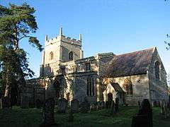
 St Bartholomew's Church, Ingoldsby |
|
 Ingoldsby |
|
| Population | 254 (2001) |
|---|---|
| OS grid reference | TF009300 |
| – London | 90 mi (140 km) S |
| District | South Kesteven |
| Shire county | Lincolnshire |
| Region | East Midlands |
| Country | England |
| Sovereign state | United Kingdom |
| Postcode district | NG33 |
| Police | Lincolnshire |
| Fire | Lincolnshire |
| Ambulance | East Midlands |
| EU Parliament | East Midlands |
| UK Parliament | Grantham and Stamford |
|
|
Coordinates: 52°51′31″N 0°30′06″W / 52.858715°N 0.50167°W
Ingoldsby is a small village in the South Kesteven district of Lincolnshire, England. It is situated 7 miles (11 km) south-east from the market town of Grantham. The village contains approximately 121 households.
Ingoldsby is a civil parish and an ecclesiastical parish.[1] The ecclesiastical parish is part of The North Beltisloe Group of parishes in the Deanery of Beltisloe.[1][2] From 2006 to 2011 the incumbent was Rev Richard Ireson.[3] The parish church is dedicated to St Bartholomew.
Ingoldsby is situated midway between Grantham and Bourne. Adjacent villages include Great Humby, Lenton, Bitchfield and Boothby Pagnell. The population of the parish is 254. Close by to the east of the village is the Roman road King Street that ran from Bourne to near Ancaster.[4][5]
Adjacent to the village is the minor hamlet of Scotland, and Scotland House.[6] They are connected by Scotland Lane.[7]
Ingoldsby forms the most southerly point of the Ropsley Triangle, which denotes the area between Ropsley, Boothby Pagnell and Ingoldsby.
References
- 1 2 Ingoldsby P C C; Diocese of Lincoln. Retrieved 14 May 2012
- ↑ "St Bartholomew's, Ingoldsby"; Northbeltisloeparishes.co.uk. Retrieved 14 May 2012
- ↑ "North Beltisloe Group Council Report for PCC AGMs."; Boothby.org.uk. PDF download required. Retrieved 14 May 2012
- ↑ Historic England. "King Street (1035135)". PastScape. Retrieved 20 March 2010.
- ↑ Margary, Ivan D (1973). Roman roads in Britain. pp. 232–4.
- ↑ Historic England. "Scotland House (505919)". PastScape. Retrieved 20 March 2010.
- ↑ Bourne & Heckington: Billingborough & Morton (Map) (3 ed.). 1:25000. OS Explorer. OSGB. 3 April 2006. p. 248. ISBN 978-0-319-23811-0.TF007302
External links
 Media related to Ingoldsby at Wikimedia Commons
- "Ingoldsby", Genuki. Retrieved 4 February 2014
- "Ingoldsby Parish Council", Cpalc.org.uk
- Ingoldsby Primary school web site