Inka Qhamachu
| Inka Qhamachu | |
|---|---|
 Inka Qhamachu | |
| Highest point | |
| Elevation | 4,792 m (15,722 ft) [1] |
| Coordinates | 18°51′13″S 68°12′42″W / 18.85361°S 68.21167°WCoordinates: 18°51′13″S 68°12′42″W / 18.85361°S 68.21167°W |
| Geography | |
| Location |
Bolivia Oruro Department |
| Parent range | Andes |
Inka Qhamachu (Quechua Inka Inca, qhamachu a species of wild tobacco (Nicotiana glauca),[2] Hispanicized names Inca Camacho, Incacamachi) is a 4,792-metre-high (15,722 ft) mountain in the Andes of Bolivia. It is located in the Oruro Department, Litoral Province, Huachacalla Municipality. Inka Qhamachu lies southeast of Pacha Qullu, southeast of the village of Huachacalla (Wachaqalla).[3]
Inka Qhamachu is part of the Altiplano, an area of the Andes lying at altitudes of 3,600–4,000 metres (11,800–13,100 ft). The Altiplano has been affected by volcanic activity. Most of it including Inka Qhamachu is extinct, but in the Western Cordillera volcanic activity persists at Cerro Quemado, Guallatiri, Parinacota, Sajama and Tata Sabaya.[4]
Inka Qhamachu is a Pliocene age volcano,[4] which rises from an altitude of 3,700 metres (12,100 ft). [5] Its slopes range 11–16°, formed by lava flows and pyroclastic material. Erosion has carved radial gullies into its flanks, at whose ends alluvial fans have formed.[4] Based on the degree of erosion, an age of 7.5 million years has been estimated. The volume of the edifice once was about 50.9 cubic kilometres (12.2 cu mi).[5]
Temperatures in the closely located city of Oruro range 4–12 °C (39–54 °F), and precipitation is 400–100 millimetres (15.7–3.9 in). The area is very windy. This climate has led to a xerophytic vegetation, including shrubs and tussock grass.[4]
References
- ↑ Bolivian IGM map 1:50,000 Escara 5937-II
- ↑ Diccionario Quechua - Español - Quechua, Academía Mayor de la Lengua Quechua, Gobierno Regional Cusco, Cusco 2005 (Quechua-Spanish dictionary) see: supay qarqo
- ↑ "Huachacalla". Retrieved January 15, 2016. (unnamed)
- 1 2 3 4 Rossi, Matti J.; Kesseli, Risto; Liuha, Petri; Meneses, Jédu Sagárnaga; Bustamante, Jonny (October 2002). "A preliminary archaeological and environmental study of pre-Columbian burial towers at Huachacalla, Bolivian Altiplano". Geoarchaeology. 17 (7): 633–648. doi:10.1002/gea.10032.
- 1 2 Karátson, D.; Telbisz, T.; Wörner, G. (February 2012). "Erosion rates and erosion patterns of Neogene to Quaternary stratovolcanoes in the Western Cordillera of the Central Andes: An SRTM DEM based analysis". Geomorphology. 139-140: 122–135. doi:10.1016/j.geomorph.2011.10.010.
Capital: Oruro | ||
| Provinces | 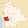 | |
| Municipalities (and seats) |
| |