Jamunkhadi Simsar
| Jamunkhadi Simsar | |
|---|---|
| Tourist attractions | |
|
Gate to wetlands area | |
  Jamunkhadi Simsar Jamunkhadi in map of Nepal | |
| Coordinates: 26°31′N 87°28′E / 26.52°N 87.47°ECoordinates: 26°31′N 87°28′E / 26.52°N 87.47°E | |
| country |
 Nepal Nepal |
| zone | Mechi zone |
| District | Jhapa District |

The Jamunkhadi Simsar or Jamunkhadi Wetlands is a wetlands conservation project in the Kankai municipality of Jhapa District, in eastern Nepal.
It was created to be developed as a tourist destination in Wards 2 and 5 of Surunga VDC (which are now the Dandagau area of Kankai), within the community forest. It lies about a kilometer away from the East-West Highway and occupies an area of about 10 hectares of the 25-hectare community forest.[1] Originally, it included two ponds named after the rivers Ganga (Ganges) and Jamuna, but due to lack of protection, Ganga no longer exists and currently only Jamuna remains.
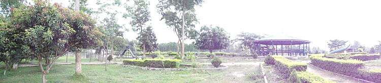
Jamuna pond is a tourist attraction.[2][3] There is boating and fishing on the pond. Wild animals such as the python, bear, sambar, and porcupine are protected in this area.
Tourism
References
- ↑ Tourism Office Kakarvitta. "जामुनखाडी सिमसार क्षेत्र". Tourism Office Kakarvitta. Tourism Office Kakarvitta. Retrieved 27 January 2016.
- ↑ "Jamunkadhi Simsar region". Birattourism.org.np. Retrieved 2016-01-09.
- ↑ [[[:ne:जामुनखाडी सिमसारक्षेत्र|जामुनखाडी सिमसारक्षेत्र]] "जामुनखाडी सिमसारक्षेत्र - विकिपीडिया"] Check
|url=value (help). Ne.wikipedia.org (in Nepali). Retrieved 2016-01-09.
External links
 |
Wikimedia Commons has media related to Jamunkhadi Simsar. |